DAY 4 POLZEATH TO PADSTOW
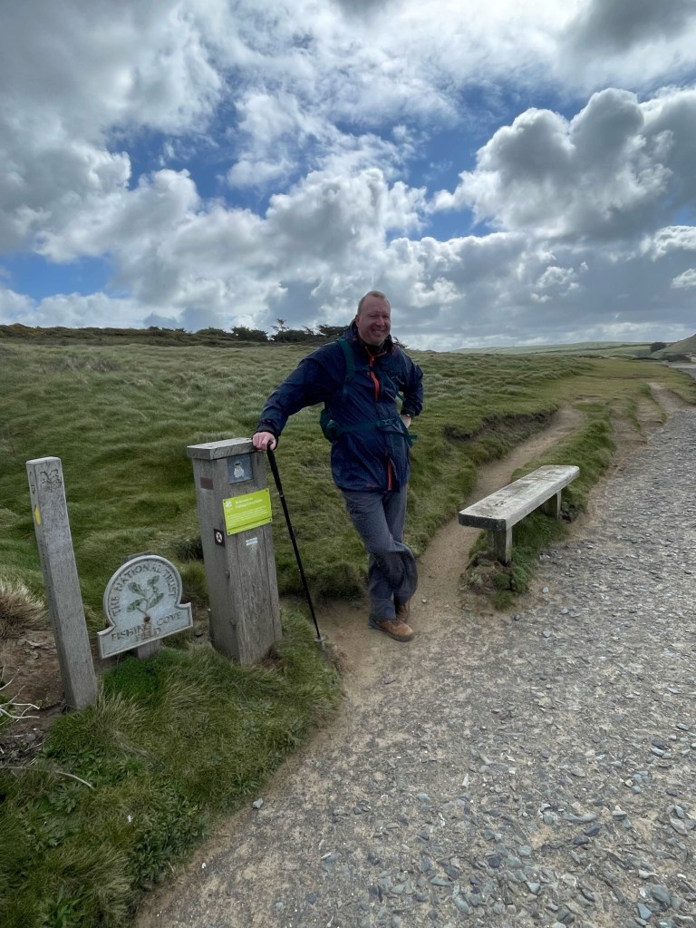
We only had a short distance to travel today, because our destination, Padstow, was a convenient place to stay over, but our lie in was foiled by Luggage Transfers who texted to say they’d collect the suitcase at nine o’clock! Paul took it down to reception, but we did linger in the room for a while as we were both feeling stiff as hell after our exertions in the previous day’s wind. On the plus side, neither of us had any issues with our feet or toes [very welcome, as we both suffered a bit last time out]. We set off around ten, although we didn’t get too far – we decided to stop in the centre of Polzeath for a sausage butty and cuppa for breakfast. A number of Cornwall’s beaches have kiosks called Beach Box, and these are all stamping points for the Path passport; I wasn’t sure if Polzeath’s would be open this early in the season, but indeed it was.
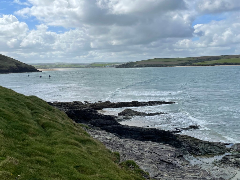
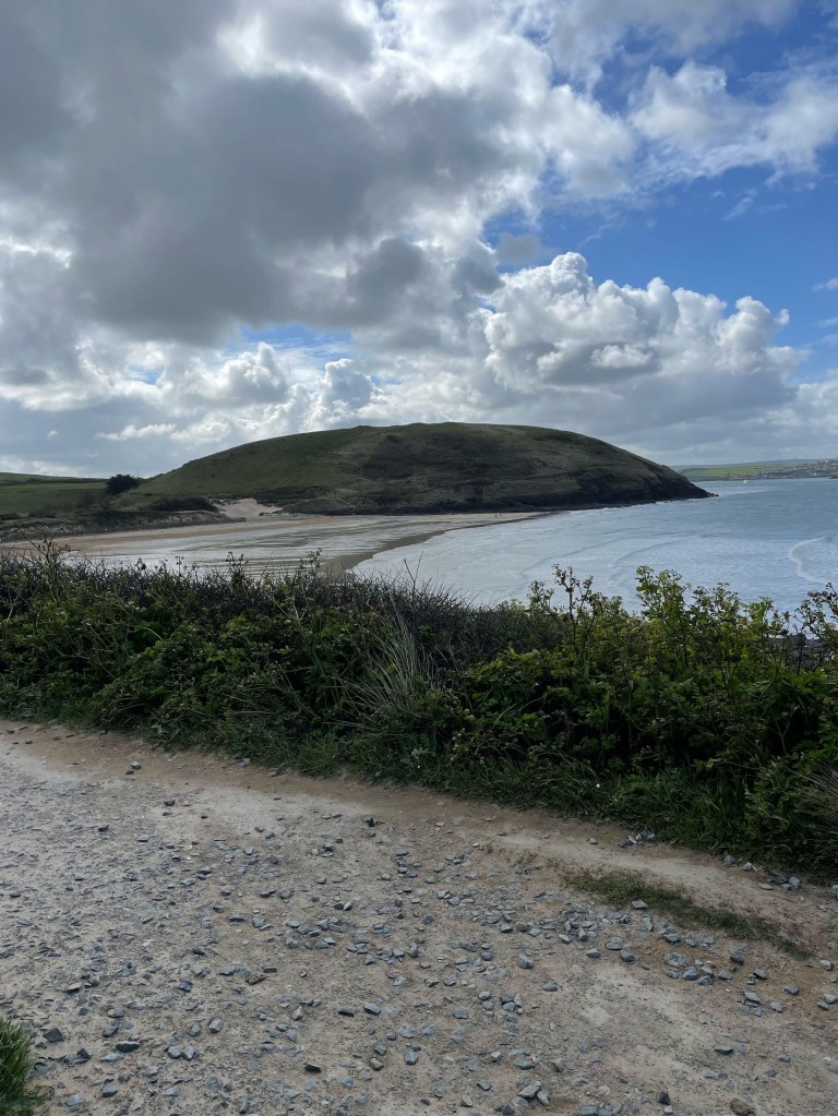
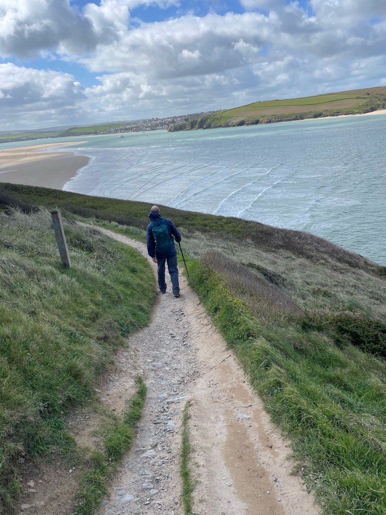
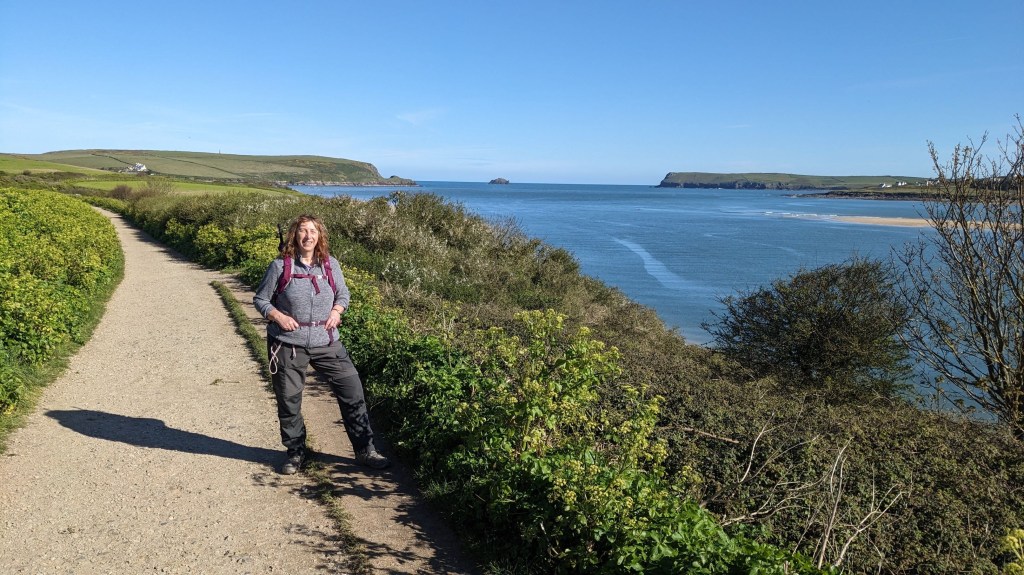
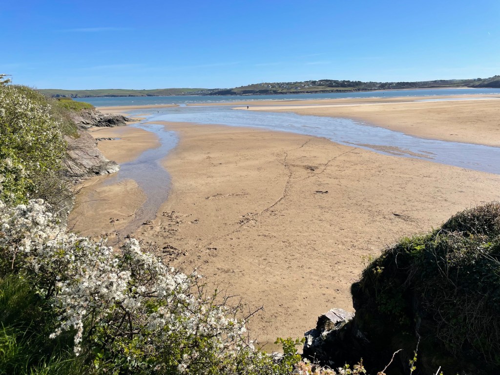
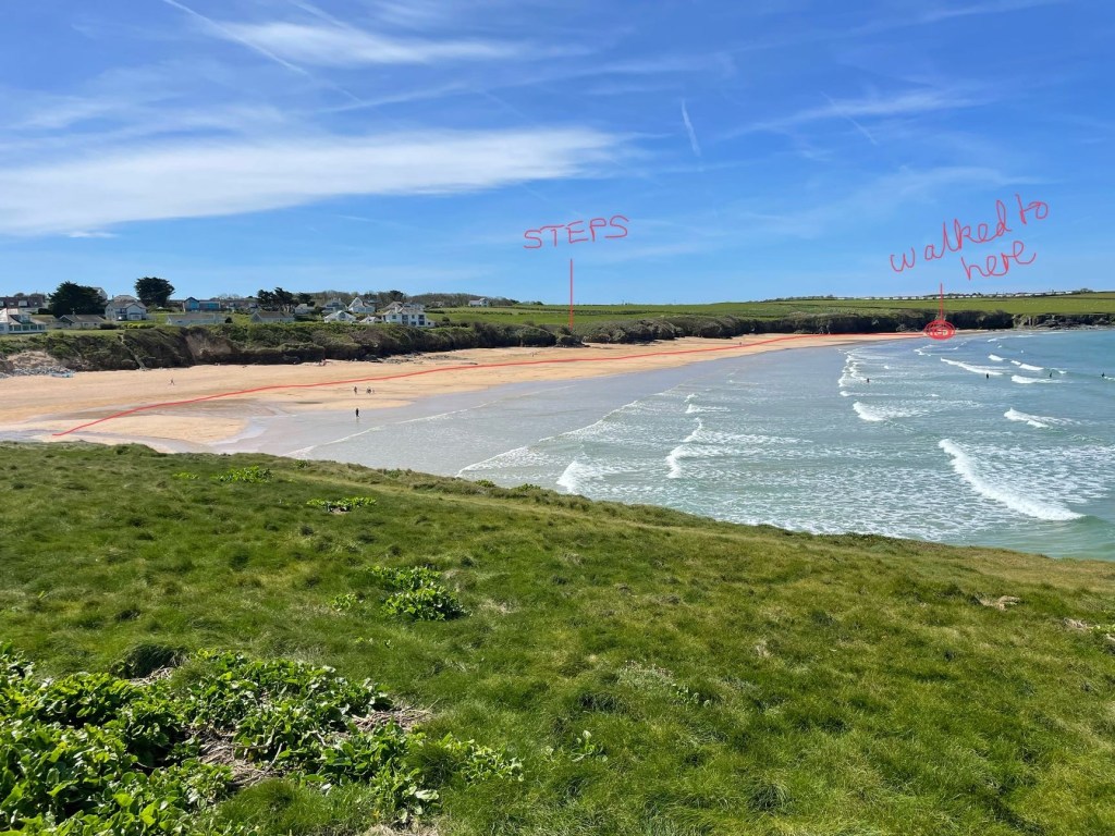
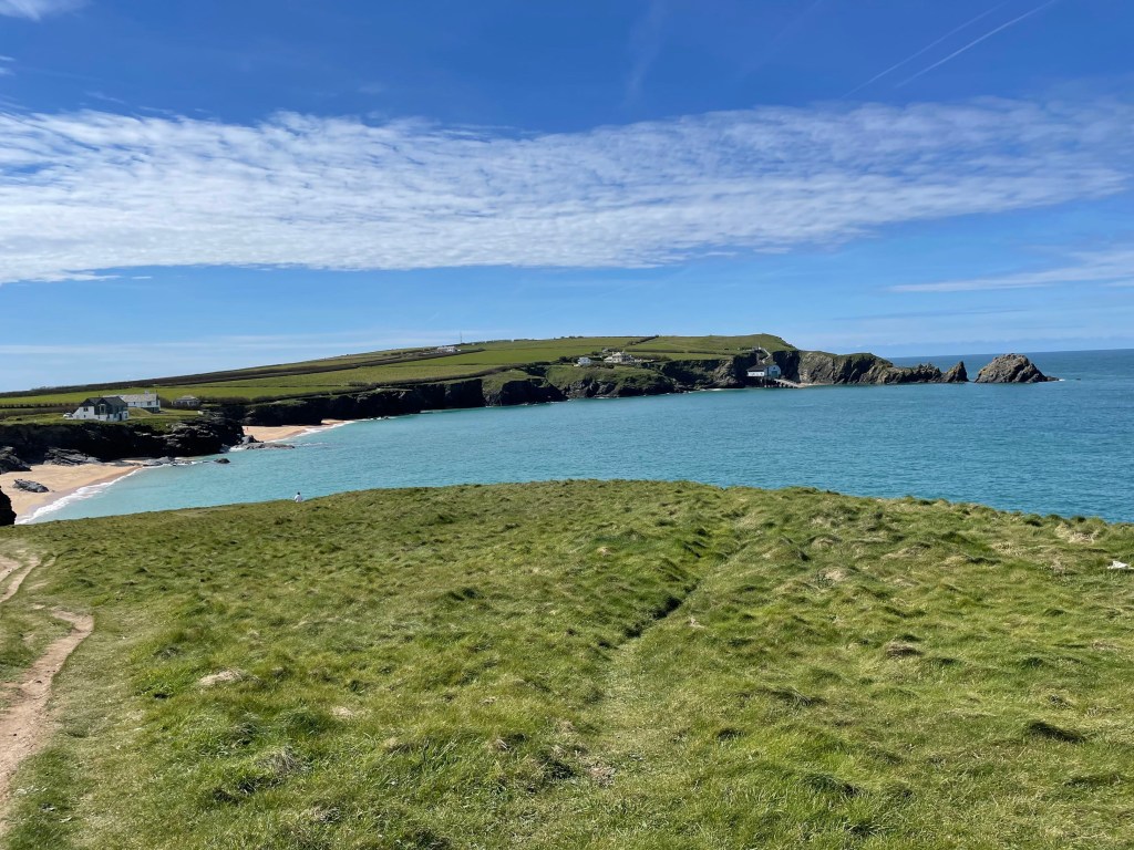
The weather had improved – there was still a fair wind, but either side of the grey cloud we couldn’t seem to escape, there was blue sky and a warmer feel overall. Conditions underfoot were excellent, Komoot rated this walk “Easy” and the path was wide and dry, if a little stony in places. It wasn’t long before we rounded the headland where the river Camel meets the sea, and here we had our first sight of Padstow on the other side. The trendy village of Rock lies opposite, but was obscured from our view by the huge round feature of Brea [pronounced bray] Hill. This is of particular interest, as my maiden name was Bray, a very common name in Cornwall, which originates from old language meaning “the brow of a hill”. Maybe this was the very one!
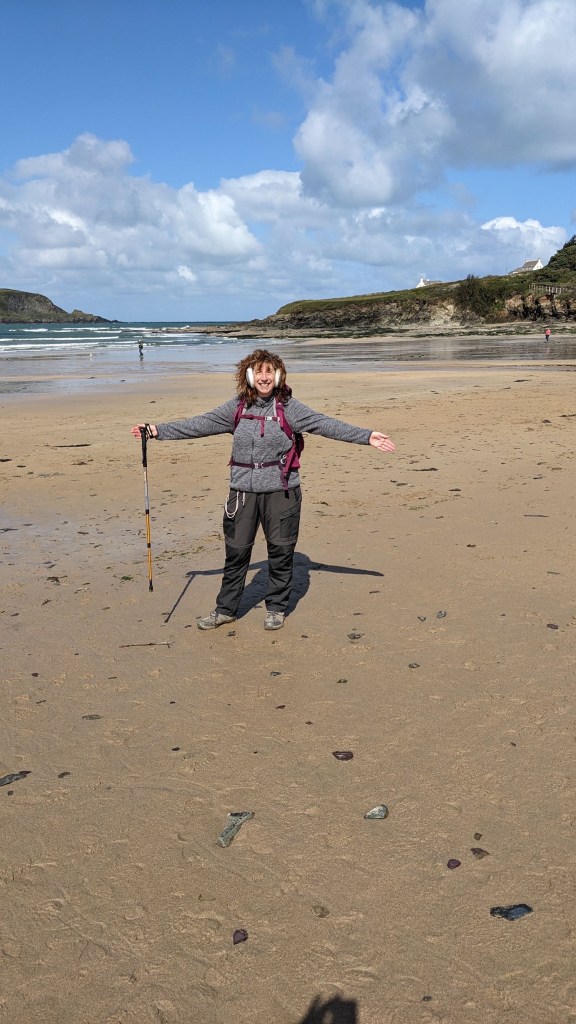
As the beach looked tempting, we left the official path to stroll across it. There were a couple of rivulets to cross, but also handily placed stones to keep my feet dry [Paul’s boots are waterproof, but my “breathable” ones mean water over an inch deep gets inside!]. We headed back into the dunes as we tackled Brea Hill, swiftly ascending via Paul’s least favourite kind of path; the ones close to a steep drop!
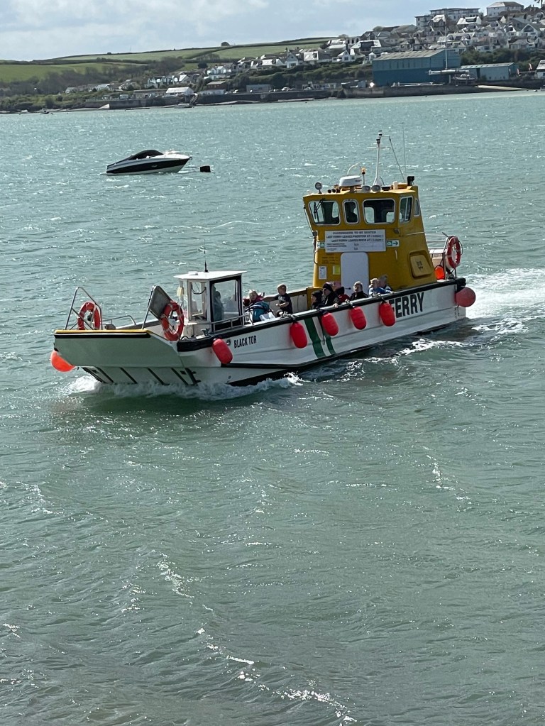
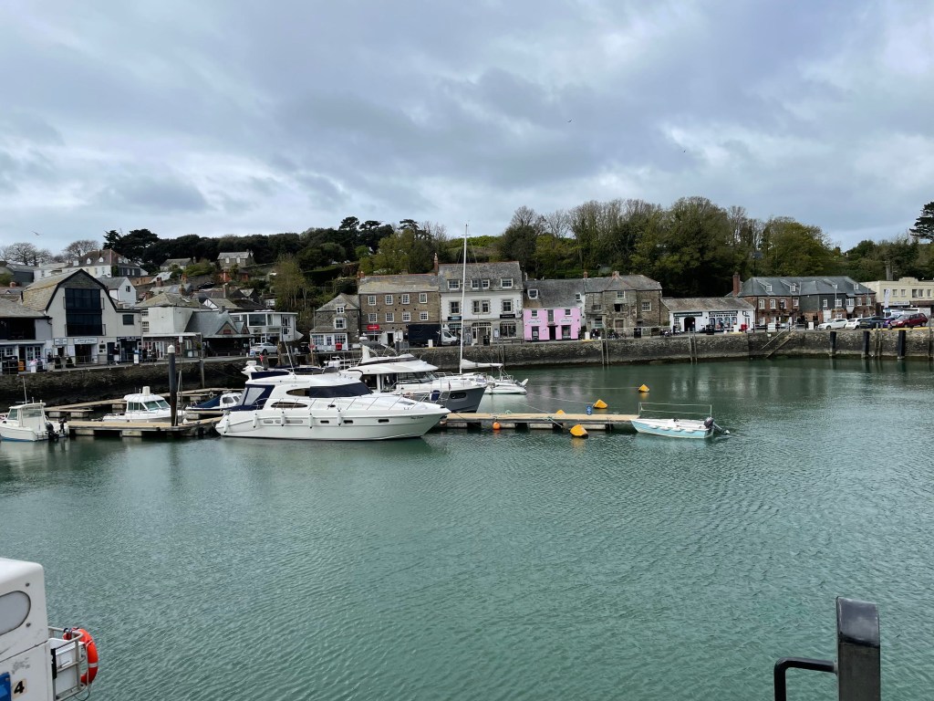
We would need to catch the ferry over to Padstow, but stopped to have lunch in Rock first. It was a pleasant ride over the river, and soon we were mixing with the day trippers milling around the harbour. Our AirBnB was in a great location in town, and there was a bath! Looking forward to a good soak, I began running the water, but it wasn’t long before the hot water had run out. I sat in a pathetic few inches of tepid water for one of the quickest baths ever. [Next day, my legs felt much better, so maybe a tiny, tepid bath is sufficient?] At least we’d had a welcome easy day with time to rest, prior to a much longer trip facing us the next day.
Stats:- Distance 4.42 miles. Time 3hrs 26mins. Pace 1.8mph. Ascent 200ft. Descent 225ft.

DAY 5 PADSTOW TO CONSTANTINE BAY
“Oh no, where’s my walking pole?” lamented Paul, realising simultaneously he must have left it at Stepper Point, about a mile back. We’d come too far to return for it, so he resigned himself to the loss, and we ploughed on. Little did we know that, some time later, the pole would make an unexpected reappearance…
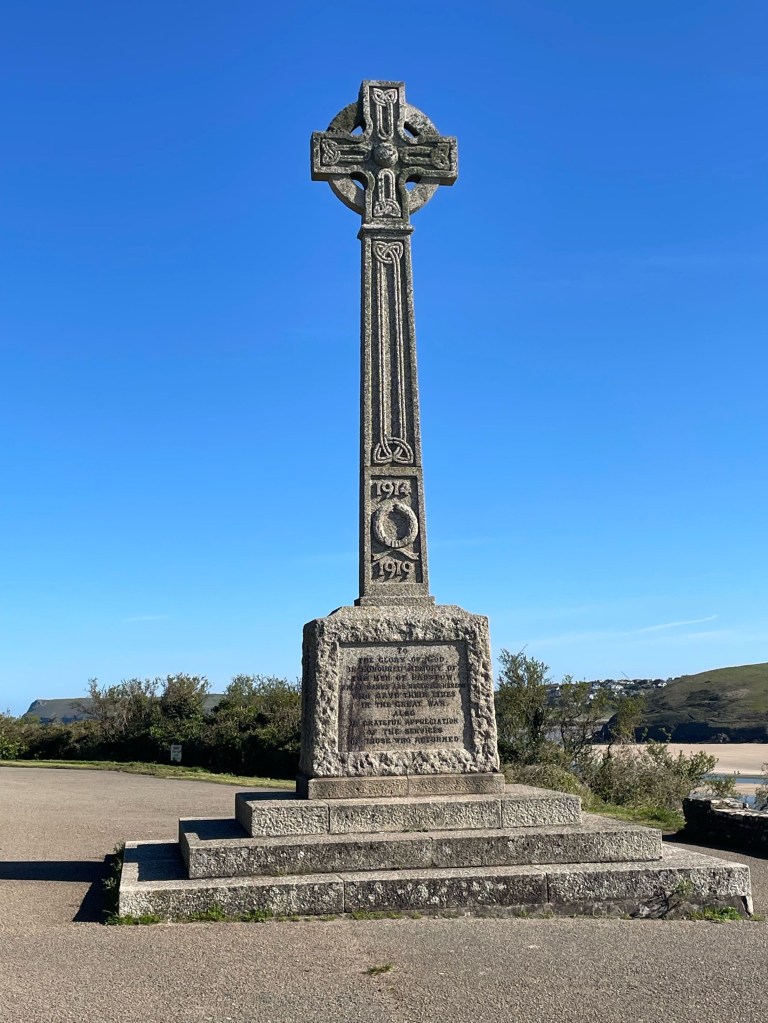
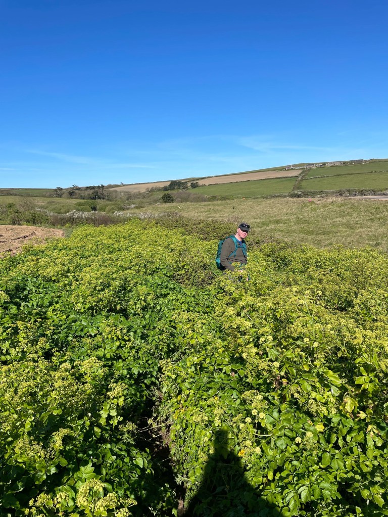
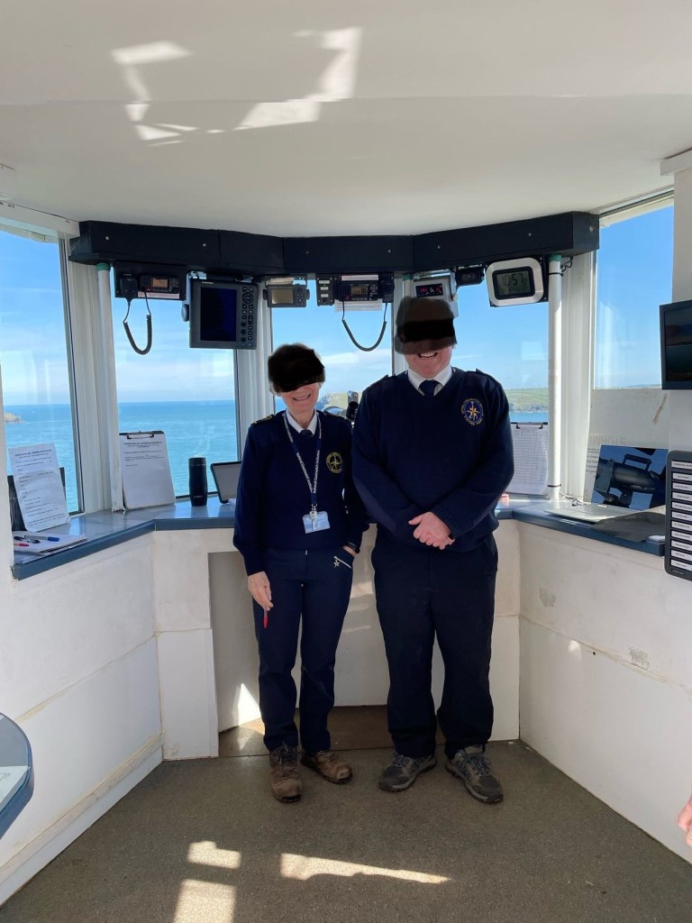
For reasons I’ll cover in the next post, we had 12 miles walking planned today, ending with a bus ride to our accommodation in St Merryn. [Paul was talking about shortcutting the two headlands before we’d even started, the skiver!] It was a pleasant surprise to find breakfast was included at our accommodation; the sun was shining, the wind had fallen to a mere 5mph, so we were feeling pretty chipper as we left Padstow, following the riverbank. As the path took us upwards, we reached a war memorial, which must be one of the best situated in the country-on the cliff overlooking the river Camel and the villages of Rock and Padstow on either side. The path was really easy going, first through woodland, then atop a beach, until it disappeared into a mass of spring foliage. We pushed through, heading slightly inland, skirting a couple of fields. Our first planned stop was a tearoom/passport stamping location, ideal for a pre lunch cuppa-oh, how my hopes were to be dashed! First off, there was a sign informing customers that there were no toilets, [really, I mean how can you offer refreshments sans facilities?] followed by a further sign saying they were closed. We sat instead on a large stone nearby for a drink from our water bottles, and I then decided to deploy the shorts option on my trousers by unzipping the bottom section. We briefly discussed going for the shortcut, but we had made good progress, so we decided to continue round the headland in full, which would take us past the Coastguard station at Stepper Point [another stamping point].
The male and female coastguards were both super friendly and chatty. The man told me about the dangerous tidal flows as the Camel meets the sea; it’s known as the Doombar, after which the beer is named. He asked about our walk [this is important as you’ll see later] and I must have said we were staying at St Merryn, but walking to Constantine Bay. Meanwhile, Paul was filling in their visitor book, and we both had a look at Lundy Island through the telescope; at 37 miles away it’s not usually visible unless it’s a very clear day.
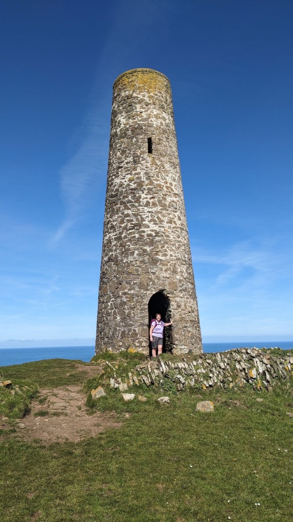
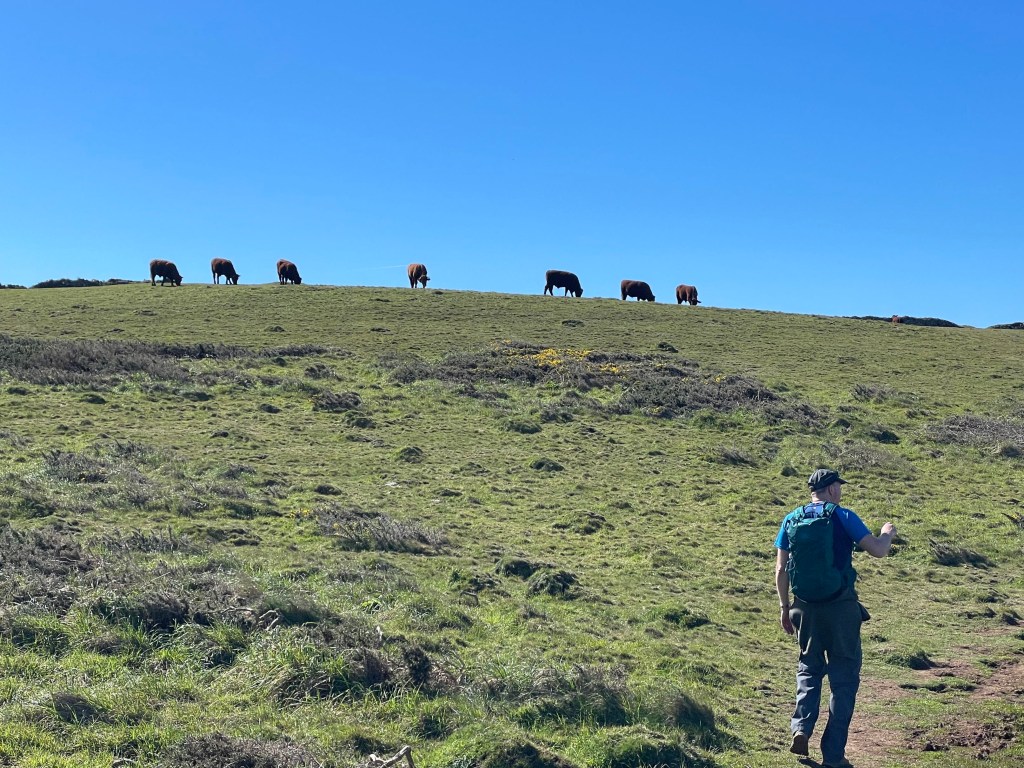
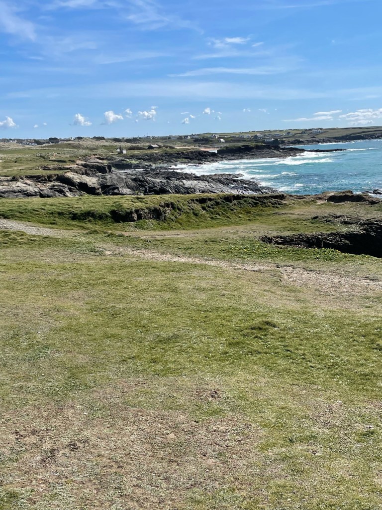
About half a mile further on was a tower, the remains of the old lighthouse, which never actually had a light, it used to be painted white. We could see the modern lighthouse on the next headland, Trevose Head. We were really enjoying ourselves now, I think this stretch must be some of the easiest going on the entire Path, and the weather was glorious [see, it’s really not all doom and gloom!]. There were some cows loose atop a nearby hill, but not close enough to warrant any panic, but as we approached a downhill section, Paul suddenly realised his hands were empty-where was his walking pole? There was only one place it could possibly be-Stepper Point. He’d put it down to sign the book. It was too far behind to contemplate returning for it, so it was with a sense of dismay and frustration that we carried on. I suggested we could ask the girls to buy him a replacement for the upcoming Father’s Day.
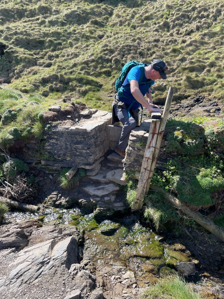
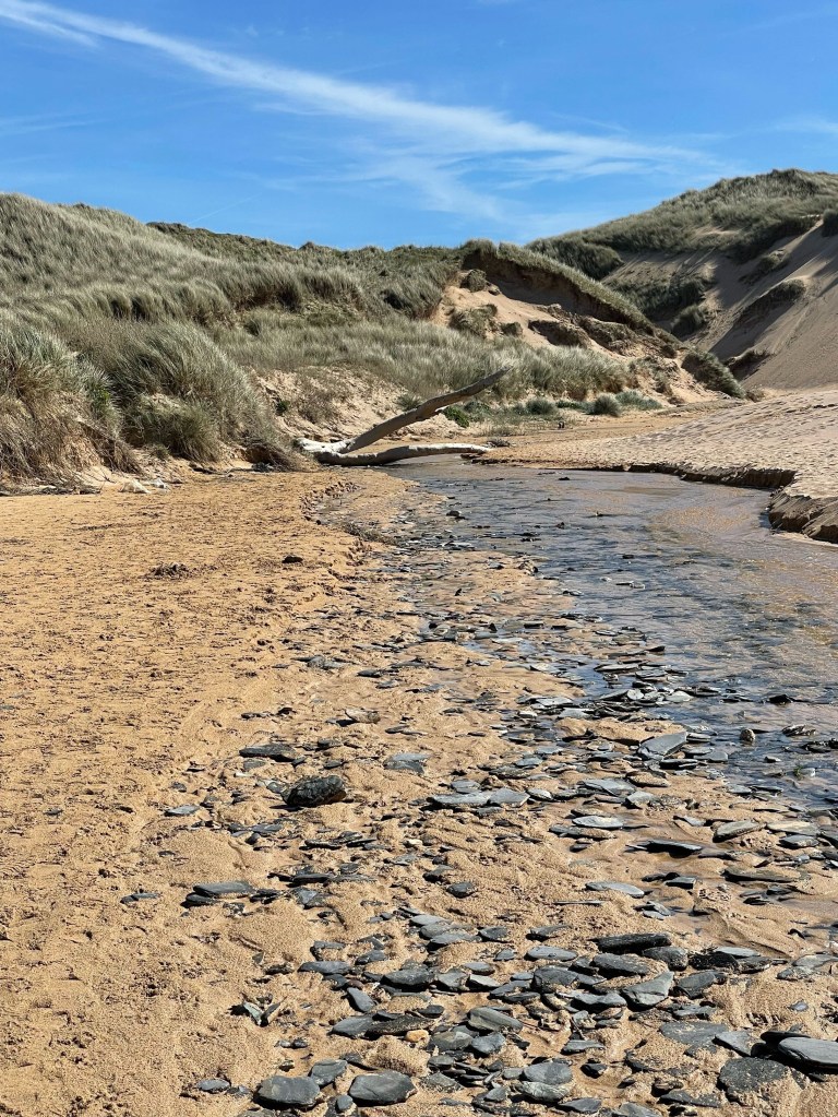
Trevone Bay had a cafe next to the car park where we stopped for lunch. Well, I say lunch, they had a very odd selection of menu items, so we settled for a drink and toasted tea cake. A short distance further brought us to Harlyn Bay where they had one of the Beach Box kiosks. We had an ice cream, and I asked for the passport stamp, to be told they had lost it! But they did sign and date it for me. At Harlyn, the Path descended to the actual beach, and we walked all the way along it before realising there was no exit up the cliffs. It’s always annoying to retrace your steps, but we had no choice. About half way back, we spotted a set of steps taking us to a path skirting a field of sheep. A little further on, we were beginning to set out onto the Trevose headland, so we would have to decide whether to short cut or not. Now, although we’d had a good day, we still had a fair distance ahead, so we did indeed take the half mile path across to Booby’s Bay [the right decision as it turned out]. This bay was rocky with a stony path; as we reached the sandy Constantine Bay, the Path proper was blocked off, so we had to walk across the beach. The sand was deep and soft, so quite difficult; although my legs had felt good today, they were getting pretty tired after our extra mileage. Additionally, there was a stream of water blocking our way, and we needed to detour to cross it. At the other end of the beach we reached a road, where we still had a good half mile slog to reach the village shop, where the bus stop was located. At the shop, we were confused by the presence of just one stop on one side of the road, before we realised that buses heading in either direction stopped there before turning around!
It was lovely to get to our accommodation at The Farmer’s Arms, and enjoy a deep, hot bath after our exertions. Unfortunately, the toilet stopped flushing, so we decided to go down to the bar for a drink and advise the landlady of our issue. There was a handful of other customers, so I was only vaguely aware of a man who walked in and started talking to a couple at a nearby table. But our ears pricked up when he asked them if they’d been walking past Stepper Point today. Paul chipped in and said we were there earlier, and it was then that I clocked he was wearing a coastguard uniform-he had Paul’s walking pole! He had come on a later shift and volunteered to drop it off as St Merryn was on his way; did I say where we were staying or did he deduce it? Either way, I can’t think that anyone would have gone to that much trouble anywhere other than Cornwall [or, as I like to think of it, my ancestral home!], though it was fortunate we just happened to be in the bar when he walked in! So Paul got his pole back, and we got a room upgrade as the loo couldn’t be fixed-what a great end to a great day!
Stats:- Distance 11 miles. Time 6hr 15mins. Pace 2.8mph. Ascent 775ft. Descent 750ft.


Leave a comment