PORTREATH TO ST AGNES
You may recall I had been in a dismal state at the end of the previous day, but I’d improved a lot overnight. My legs had recovered, but my toe was in poor shape, and the base of my foot was still uncomfortable. I think I had discovered why though; my right foot was sliding inwards with each step because the upper of my boot had loosened and deteriorated such that it was no longer providing sufficient support. I decided I would need a new pair before our next foray, but for now I would just have to plug on. We left our accommodation at 9.30am, but only got as far as the end of the road, where we sat outside a bakery enjoying a latte and croissant.
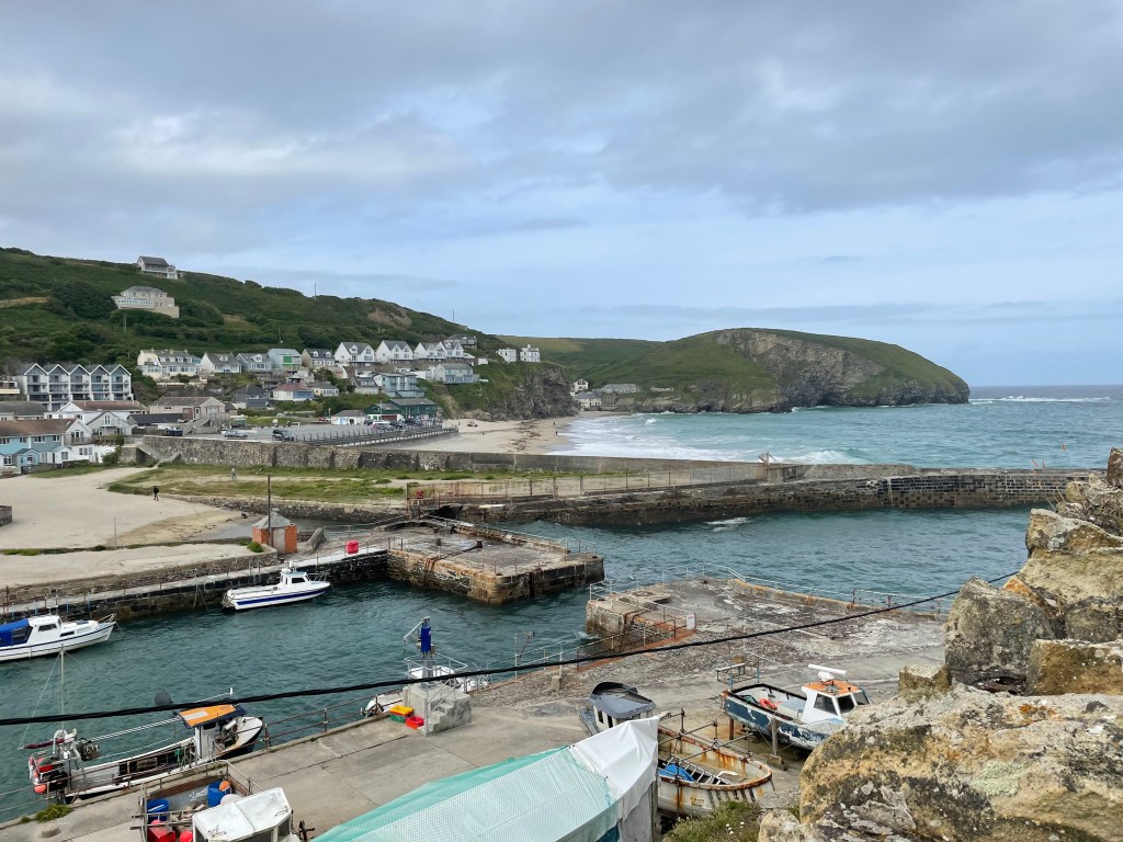
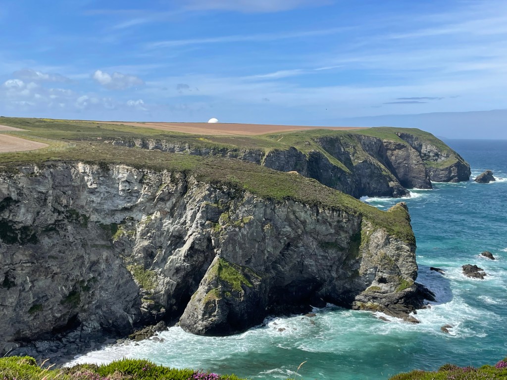
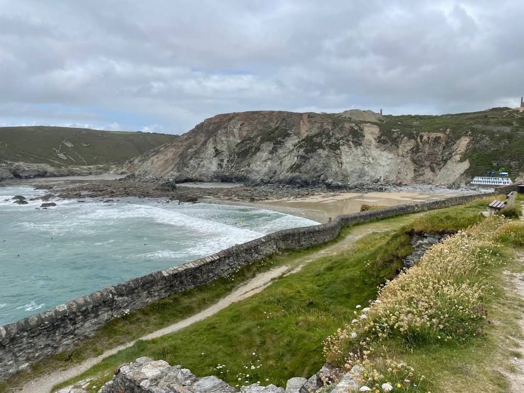
After brekkie we made our way through the village back to the beach, where we picked up the Coast Path, heading uphill with plenty more wildflowers lining the route. There was a fire engine in a car park by the track heading out onto the cliff top, and we saw evidence of water spillage. The smell of smoke preceded our coming across three firefighters, digging out blackened soil right on the cliff edge. We stopped for a brief chat before resuming our journey along the cliff. Paul had asked about RAF Portreath, as we were about to pass the perimeter, but were told it’s mostly a listening post, there was no flight activity apparent. All we could see of it was a massive white sphere. By noon we had covered the 2 1/2 miles to our planned lunch stop at Porthtowan. I got my passport stamped, and then we had a good rest at the Beach Cafe.
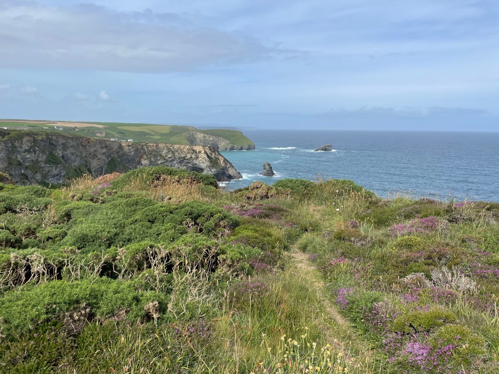
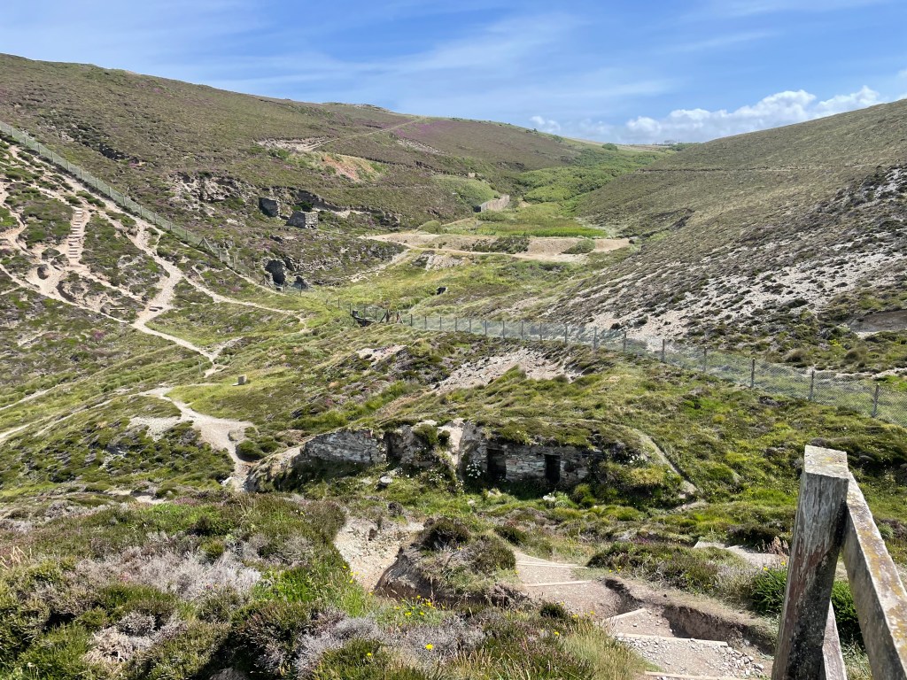
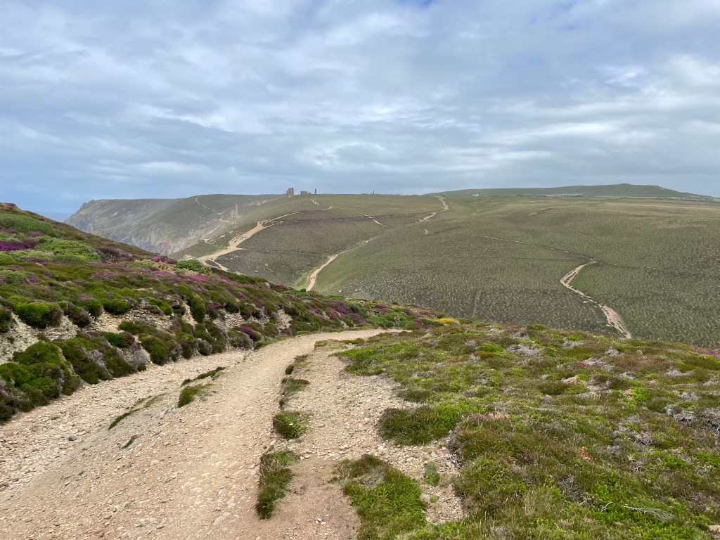
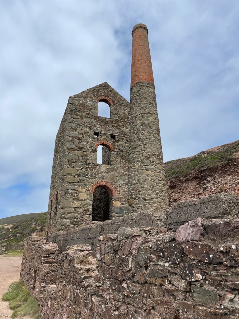
The stamp for West Cornwall is a mineworks tower, and this stretch had plenty of evidence of former mining activity, in various stages of ruin. Some buildings were barely there, but another, though a shell, still had a complete tower. Sometimes they just popped up in the natural landscape, but we also walked through one area totally transformed, with mini mountains of loose stones and spoil.
The weather had been lovely all morning, but as we set off again, we experienced one of Cornwall’s well known sudden downturns as it began to rain. This was particularly bad news, as, having logged 0% chance of rain on the forecast, I had left my waterproofs in the suitcase [I like to save weight in my rucksack wherever possible]. I zipped up my fleece and resigned myself to getting wet! My photos don’t show the bad weather, I guess I kept my phone in my pocket!
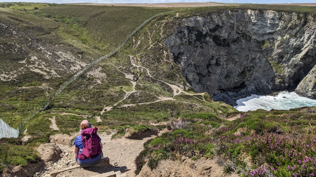
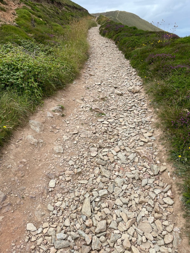
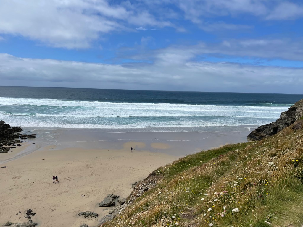
It was double misery, as the ground was horrible to walk on, sharp, stony, loose scree, especially nasty when your feet are still feeling tender. I had forgotten about the ascents until I looked at the stats again, they were quite significant today, but it was mostly steps, so easier to rest in places. [I posted a teaser photo back in June with me pulling a face at a huge flight of steps ahead, and it was taken on today’s section]. A little joy was restored with an ice cream at Chapel Porth, and by the time we left, the sun was attempting to break through again.
Our solace was short lived; by the time we were crossing the open heath atop St Agnes’ headland, the weather had changed again. In my voice memo, I described it as “a torrid 20 minutes” as we suffered heavier rain alongside a strong wind. Our shorts got properly wet, and we were still scrambling over unpleasant terrain, but with only a mile left to St Agnes, I was confident I could make it [Paul had been quite concerned about my condition the night before, oh what lack of faith in my stiff upper lippedness!]. In the heart of the village, Driftwood Spars was our pub stay, though we were located in a line of rooms in an annexe over the road. A good shower, meal and rest [and re wrapping my toes with fresh Compeed] set me up well for the next day.
Stats: Time 3hr 33mins. Distance 8.5 miles. Pace 2.4 mph. Ascent 1050 ft. Descent 1000 ft.


Leave a comment