DAY 1 WESTWARD HO! TO HORNS CROSS
It’s summer 2025, and we chose this time of year to tackle a stretch which incorporates one of the most notorious sections of the Path, Hartland Quay to Bude, (more on that as we get to it) as it is much easier to rest on a fine day than on a wet one. Of course, being a British summer, nothing is guaranteed (more on that later too!).
Our starting point was Westward Ho! in north Devon (the only place in Britain to include punctuation in its name) but we were parking in Bude, our destination. The first problem was simply getting to Westward Ho! Via public transport, we were looking at three buses and hours of travel, so we decided to stump up and book a taxi. At least the driver did save us some money by telling us where we could park for free in Bude.
Our night’s stay was at the Waterfront Hotel, where there happened to be a quiz night-we won a bottle of wine for a particular round, and then £45 for winning the quiz overall-a great result, but a shame that we had to leave the wine behind as the suitcase was rammed!
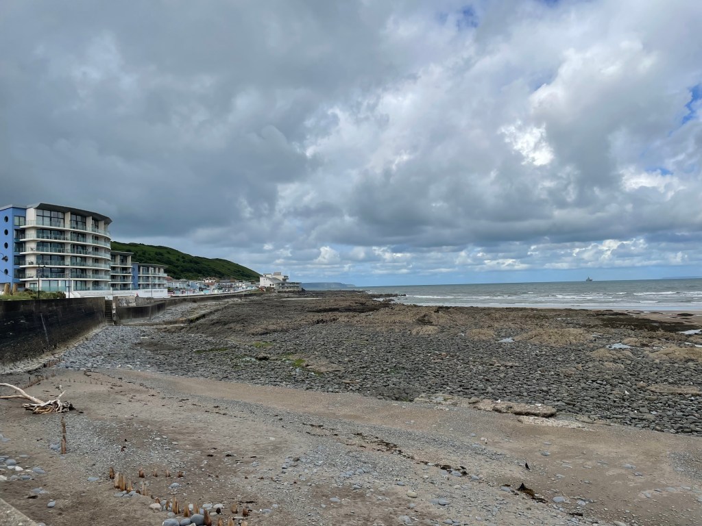
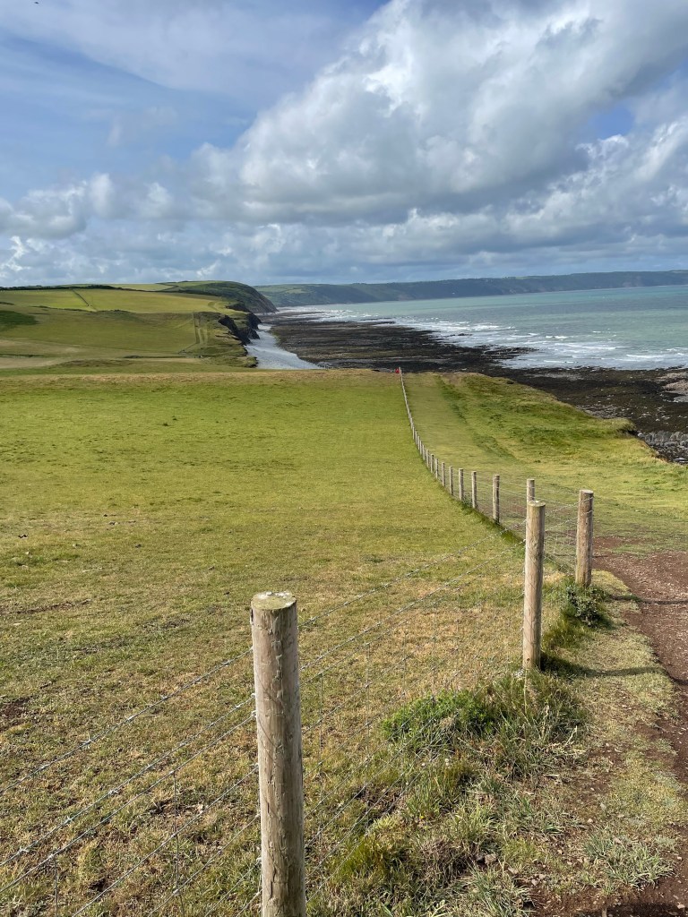
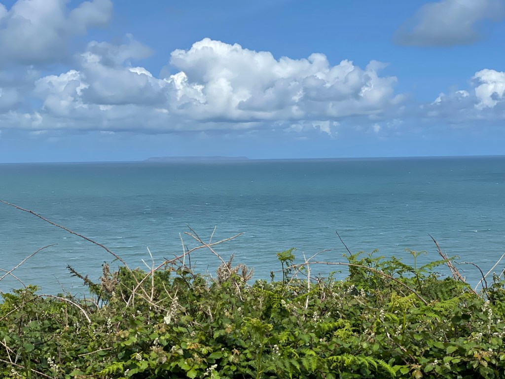
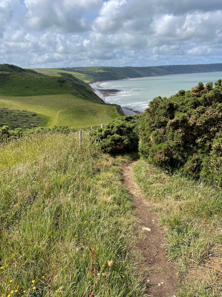
Next day, we got going about 10am, with a nice, easy start on tarmac through the town alongside the sea. It was very pleasant, but surprisingly quiet, and like many seaside towns nowadays, wears a slightly jaded air. It was overcast and gusty, but dry. On the edge of town, we passed “the famous” Seafield car park (a local business man leased it for 50 years from the council and immediately doubled the spaces and ripped out the parking meters, leading to it being featured as a small piece of parking heaven on a TV programme named Parking Hell!). The good vibes obviously rubbed off on me, as I started waxing lyrical about the sun coming out, the newly sheared sheep, and birds circling above us. I also took my first photo of Lundy Island, which would be our constant companion on the horizon this week.
By mid morning I was grappling with the eternal dilemma of fleece on or off. I get warm very quickly, especially uphill, but on a cool, windy day, my arms are just too cold without it. Judging by the photos, it stayed on!
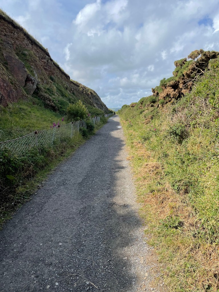
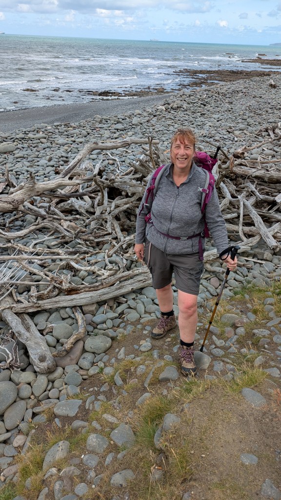
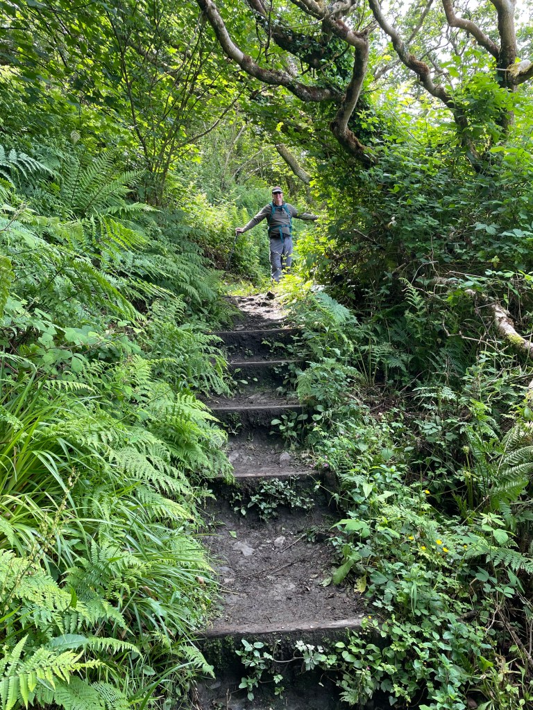
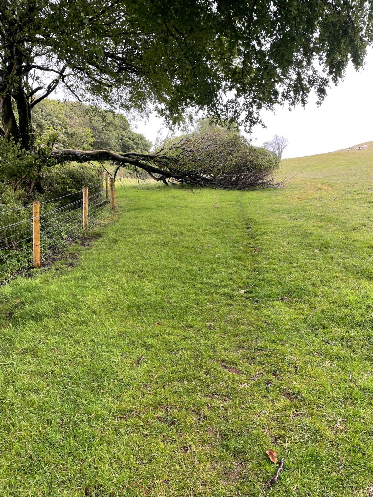
The track was, for the most part, earth with stones embedded within-exactly the type that had led to my calamitous fall on the previous leg, so I was taking great care. Doubly so when the path narrowed due to excessive foliage and became steep and muddy. It took us right down to beach level, a rocky, shingly one, so of course, after a mere 20 yards or so, we were heading straight back up again via a wooden set of steps.
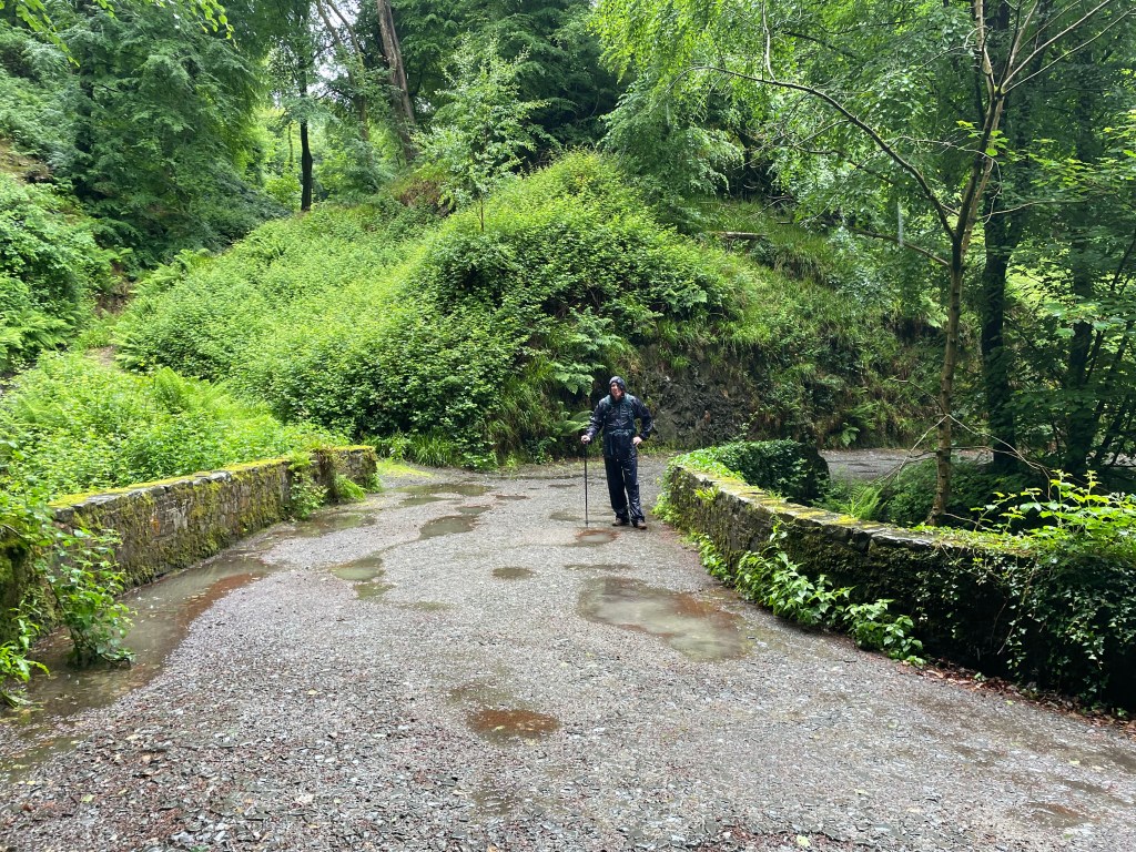
We had a packed lunch today, and stopped by the remains of a small fire and sat beside it on a small log from a dead tree. Any seat is better than the ground, but we were both slightly concerned about getting up again as it was so low down! Progress had been satisfactory, we were feeling all right (early days, ha ha) and the Hoops Inn had called to book us into the restaurant for dinner (I love staying in pubs, alcohol readily available and dinner a few steps away).
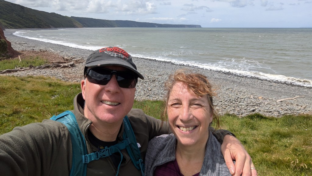
We resumed walking just after 1pm, nothing too troublesome until we got to Peppercombe beach-the path took us off into woodland, primarily uphill, and the many steps were still quite muddy. We just took it steadily, and rested frequently. By 2.30pm, we had turned off the path onto a country lane to take us inland to Horns Cross, our stop for the night.
Reflecting back on the day, it was mostly positive-we had decided on preventative action regarding blisters, and had placed brand new silicon caps, clear ones with small holes in them, on our two smallest toes, and they had done a great job of protection. We’d had a nice warm up at the outset, but some tougher sections later on. Our legs were feeling tired as we literally clambered over the last stile (never Paul’s most stylish moment) and I suffered a bout of cramp. However, we had the rare pleasure of a bath at the Hoops, which helped us recover, and feel good overall about the first day’s walk. Pity the weather wasn’t looking especially fantastic for our next day though…
Stats:-
Total time 4hr 51mins, moving 2hr 47mins. Distance 7.31 miles. Pace 2.6mph. Ascent 1275ft. Descent 800ft.
DAY 2 HORNS CROSS TO CLOVELLY
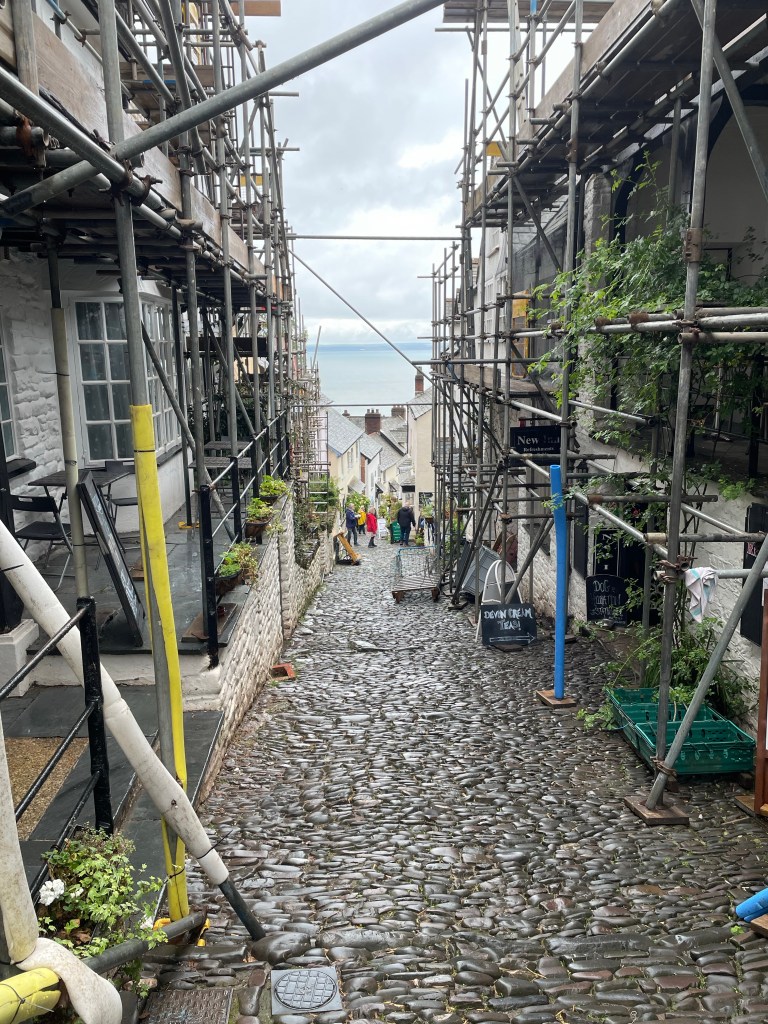
Clovelly, our destination for today, is not your typical village. In fact, it’s privately owned, so you need a ticket to park and enter if you wish to visit the various attractions (one ticket covers all). However, as we would be walking in, no fee for us! (The same rule applies at Land’s End, which is also privately owned, but doesn’t charge walkers on the Coast Path.) The village starts at the top of a steep cobbled street descending rapidly to sea level. Vehicles are prohibited, so there is a unique system in place for transporting goods and suitcases-they are placed on wooden sleds which are hauled up and down. First though, we had to get through a wet day in the woods…
With less mileage to cover today, we began with a leisurely breakfast and prepared to leave at 10.30am. Although I hadn’t mentioned it in my voice memos the day before, my knee must have been twinging because I put my knee pad on today-however, I hadn’t even got through the car park before I realised it was useless now; all those months spent squashed in my rucksack must have stretched it out, and it was now too baggy to be of any use, or even remain in place. I removed it and took a couple of Naproxen instead!
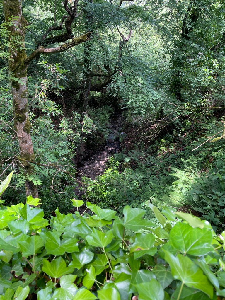
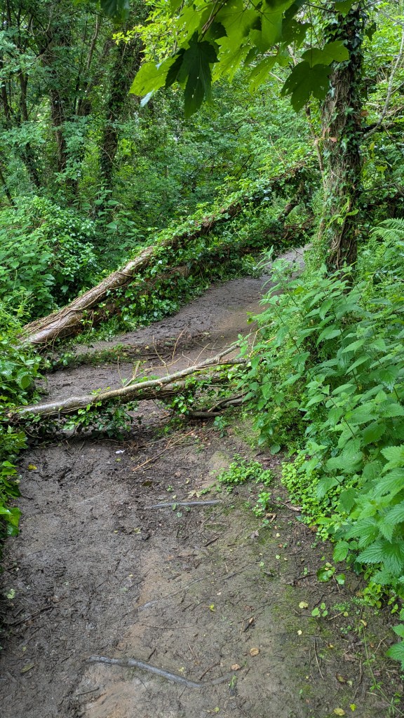
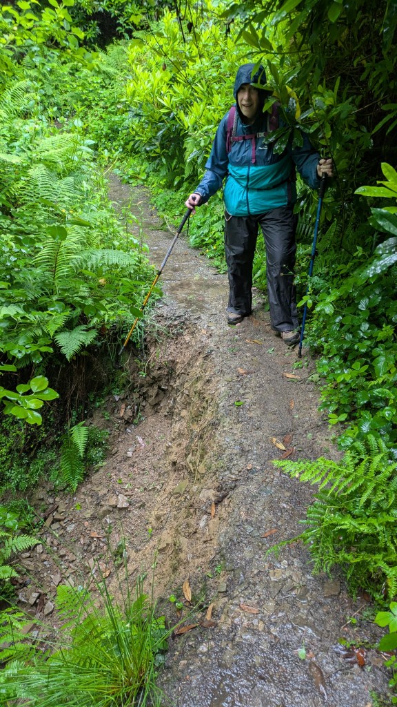
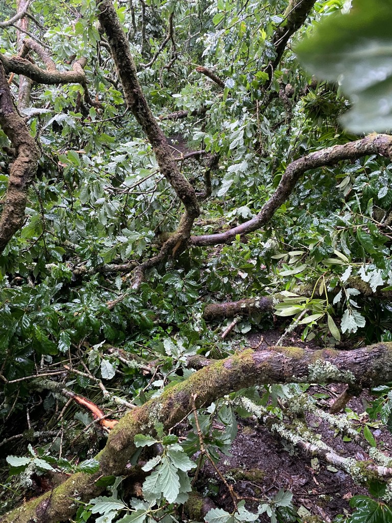
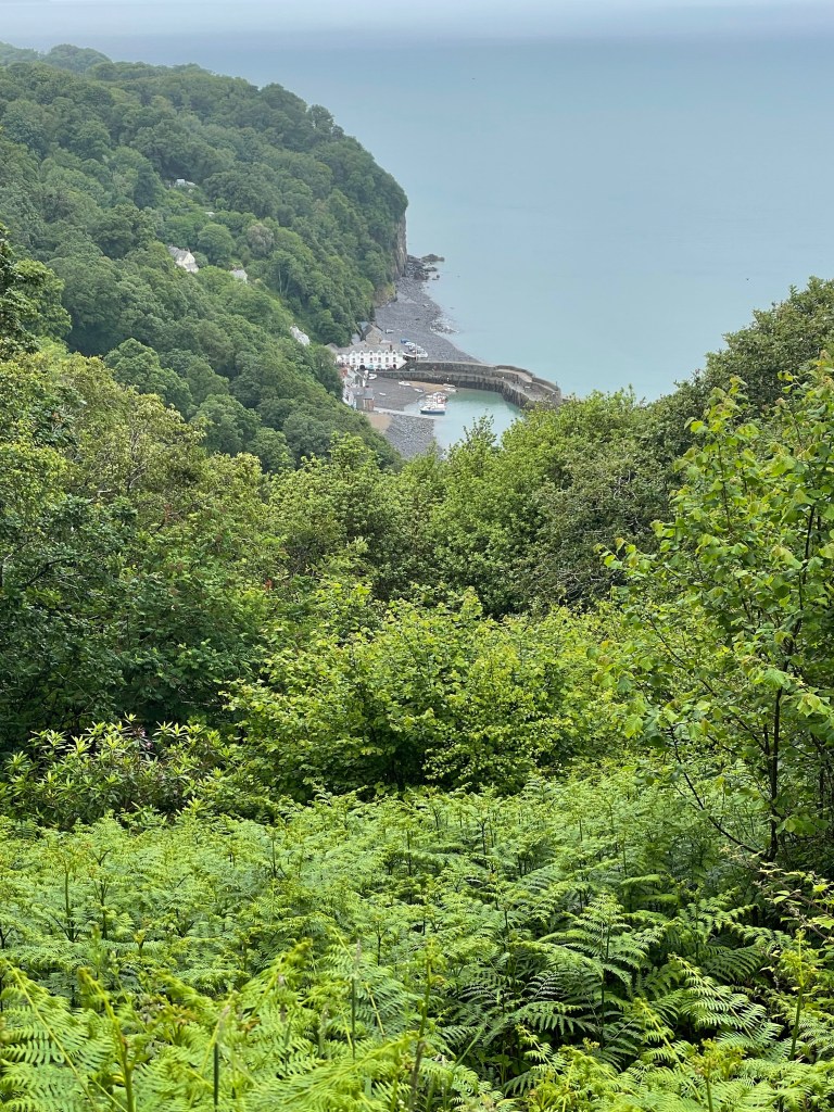
As it was drizzling I had put my waterproof coat on at the outset, but by 11.30am it was time to deploy my new more robust waterproof over trousers-these beauties have a full length zip, so can be put on without removing my boots. We had reached the woodland section now, so as well as the rain, we were brushing against wet foliage and dealing with mud underfoot. After popping out at the hamlet of Buck’s Mill, it was straight back into the woods and the first gasper (i.e. ascent) of the day. There was one area where the ground had slipped away right next to the path (see photo), so I pushed myself into the foliage to get past safely. Next, a couple of trees had fallen across the path, but they were easy to climb over; a little further on we came to a complete blockage! The route wasn’t visible at all, and Paul began to investigate a walk around just as I heard a voice asking if there was a way through. It was a walker trying to come from the opposite direction. She said she had already scrambled through most of it, so I told her to keep coming and she succeeded in breaking out! With no way around, we set about clambering through ourselves-wet branches flicked back in our faces and my hands got dirty holding branches up or down to climb over or under (I hate having mucky hands!) but we did find the path again (we reported the blockage to the South West Coast Path Association, but fellow walkers on Facebook said it had been that way for some months! Hopefully, it has been sorted now).
We were hoping for a lunch break at a holiday park where Google Maps showed a convenience store should be located-unfortunately, we managed to miss it completely. There should have been a path out of the woods to it, but there was nothing obvious to us. Instead we emerged onto a disused road (called The Hobby) that would take us the final two miles into Clovelly; it’s not overly interesting, but it was a welcome respite from the woodland, as borne out by the pace stat. We were getting quite hungry now, so we had to break into our emergency rations of Snickers and oatmeal bars, washed down with water, whilst we stood under a tree for some minimal shelter from the rain. Paul was looking exceedingly soggy as his waterproofs were the thin pac-a-mac type. My trousers were holding up but my coat, whilst better than Paul’s, was still too thin for a full day in the wet, so it’s fair to say we weren’t exactly feeling joyous today.
At least my knee couldn’t have been an issue in the end, as I don’t mention it again in my memos. I did reiterate that both our toes were in tip top condition after two days, which boded well for the week.
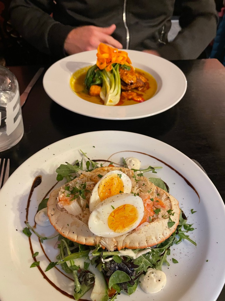
I had originally looked to stay at The Red Lion in Clovelly, a pub right on the harbour, possibly the last building in the village, but the quote was a ridiculous £250, so I had opted for The New Inn, halfway down instead, and less than £100, with the downside that we would have to share a bathroom with the other rooms on our floor (looking at the website, there seems to have been a renovation since). At that time it was basic, but clean and functional, and we were let in early, always a bonus! Despite my fears, the bathroom was only engaged once when I needed it, and all was quiet when I scurried along the corridor in the middle of the night (twice actually, ho hum). As for the pub itself over the road, there was nothing new about The New Inn, it’s been there for hundreds of years and some of the furniture looked just as old! It was dark, cramped and filled with very plain wooden chairs, but appearances can be misleading; the welcome was warm and the food was absolutely fabulous! I had fresh crab and was so impressed I took a photo before we tucked into it. A lovely meal and a bottle of wine is the best cure for one of the less enjoyable days on the Path. We were to be blessed with good weather from here onwards though, so just the terrain to deal with now!
Stats:-
Total time 4hrs, moving 2hrs 2mins. Distance 5.91 miles. Pace 2.9mph. Ascent 675ft.
Descent 850ft.


Leave a comment