LEG 1 DAY HIKE POOLE TO SWANAGE
BOOMERWALK LEG ONE Day Hike
Our younger daughter, Holly, is home for a few days, so we invited her to join us on our next training walk, back on the Studland headland, but this time following the Coast Path proper all the way to Swanage. The idea was to lunch at the end of the walk, so it was an early start, in the car at 9am for the journey to the main car park at Sandbanks beach. It was a short walk along the road to the chain ferry-we watched it arrive in some choppy waters due to a strong wind. We had to shelter behind the window section as it was blowing so fiercely on the exposed parts of the ferry!
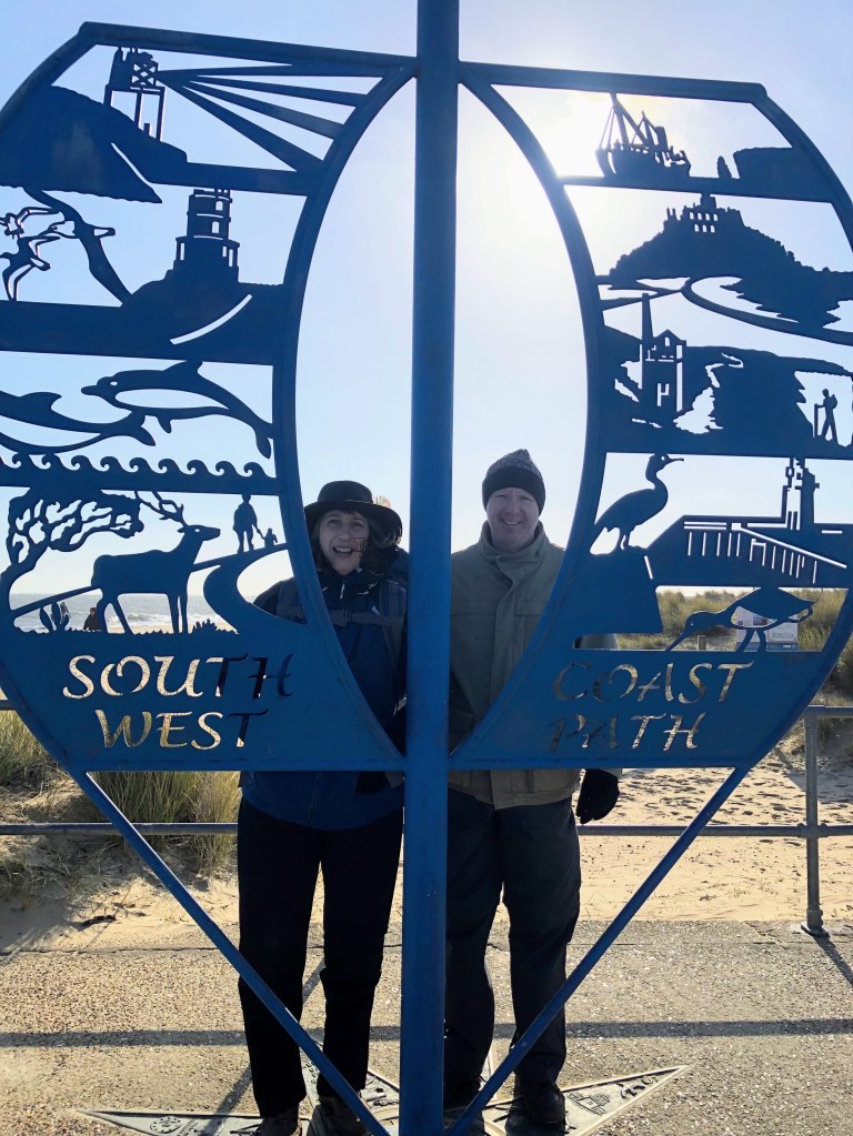
We stopped to pose for a photo at the Path sign, but the sun was inconveniently behind us, so we and the sign were both in shadow, technology has fixed the lighting so end result not too bad. The “path” here is actually all along Shell Bay beach [yes, that does include crossing the Naturist section, not that there were any around on this occasion, unsurprisingly] just plenty of walkers, with and without dogs. Paul was trialling his new zip off trousers [bottom section on today] and I was wearing all my gear and carrying the rucksack too. Holly was in her trainers and ankle grazer jeans-Paul categorised me as the professional, himself as the semi-professional, and Holly as the amateur [oh, how that joke backfired as Paul and I dragged our weary legs along Swanage seafront while Holly sauntered along untroubled-youth outweighs training evidently!].
Walking on sand isn’t easy at the best of times, but we were heading into the wind, and the shifting ground underfoot meant it was a challenging start for my dodgy foot, though we kept up a good pace. At the end of the beach we headed upwards for the walk atop the headland, and swiftly came across two relics of World War Two fortifications-an early pill box gun emplacement thrown up in 1940, and a later observation post, Fort Henry, for overseeing training exercises in 1943/4. We soon joined the path to Old Harry Rocks which we had walked in the opposite direction a few weeks ago. At this stage, my right toe was beginning to chafe again [see What Goes Up, Must Come Down for the origin of this issue] annoyingly, as I thought I had solved this by removing a ruck in the inner lining and wearing smooth socks-it had been fine the week before. Fortunately, I had prepared and packed the medical kit, so we had a brief stop to eat the tangerines I had brought, and for me to put a plaster on my toe, which did help. I think I’ll have to just put one on before every walk from now on.
Fortified with fruit, we continued on to the other side of the promontory from where we could see Swanage Bay. At this point the path is very close to the edge of the grassy cliff which made me a little nervous in such a strong wind. However, the path descended rapidly where we were more sheltered and also where we briefly stopped to admire a hang glider overhead. It then became steep enough to make my knees feel the strain [as I’ve said before, going downhill is not the breeze you would think] with some large drops on steps too, though I was pleased that neither of my joints broke down, just a bit of aged crumbliness methinks! When Paul offered to take over carrying the rucksack I did agree to make life a bit easier, though of course, I’ll have to carry my own on the real walk. We were nearly at beach level when we were faced with a division in the path-carry on heading down to the beach or cross a wooden bridge and stay on the top of the headland. We sent Holly up to have a look and indeed the coast path stone marker was up there [would have been more use at the lower level] so we were reassured as we walked through the outskirts of Swanage itself that we were sticking to the designated route.
I was getting exceedingly hungry by now [we don’t do breakfast in our house] and after another half mile we passed a pub, which, by happy coincidence, was right by the bus stop for our ride back. However, Holly maintained that having come this far, she wanted to go all the way to the seafront [half a mile according to a road sign, one mile to the town centre] so as we are indulgent parents now our children are adults, we agreed to carry on. Big mistake! The waterfront bar was closed so we had to go all the way into town-I started slowing down at this point, my legs were getting very tired. This was our longest walk to date at nine miles, to be fair. But when I saw a bench, I plonked myself down and told the others to find somewhere to eat [I had visions of trailing all around town] and off they went. After what seemed an age, during which time I’d got pretty cold, Holly reappeared and finally we had our reward of food and alcohol. It was only five minutes from there to the bus, where a whole horde of people piled on, I can’t remember the last time I was on such a full bus! Unusually, it wasn’t one of the open top ones, but it might just as well have been, all the upstairs windows were open (with a note to keep them so) and I got cold all over again. As soon as I got home I ran myself a bath, and soaked in it, drinking a gin and tonic. Aahhhh!
Take away from this walk is that I was pleased to manage a longer distance, but I am going to need a longer rest at an earlier stage in order to go further, as I was all done in by the time we hit Swanage. Bulbarrow Hill is in our sights next.
LEG 2/DAY 1 WEYMOUTH TO PORTLAND
My phone rang. “I’m sorry, but I’m afraid we’ve had a power cut at the hotel, I wanted to warn you in advance, as I didn’t want you turning up to find we have no electricity, hot water or lighting.” Aarrgghh! Not the news you want to hear when you’re having lunch over half way into your walk and you’re already sweaty and tired! You may remember we had already altered our overnight stay when the pub cancelled on us two days earlier. It had all started off pretty smoothly too…
Rucksacks packed with the bare minimum, but still a significant weight compared to the training walks, we caught the 8.09 bus to the station and the 8.52 train to Weymouth which took about an hour. We planned to “avail ourselves of the facilitays” as Paul likes to say, before setting off, but there are no loos at Weymouth station any more [apparently, they kept getting vandalised, so they got closed!] so we took a minor detour to Wetherspoons first [I moan about Spoons regularly, but they’ve proved exceedingly handy on many an occasion]. We began with another slight deviation-the official Path goes along the seafront and has you taking a ferry [in the form of a rowboat, we believe] to get across the harbour. We decided to walk down the main street and simply cross the bridge instead! After passing through a residential area, we then picked up the Path, a nice bit of level tarmac heading towards Ferrybridge, the link between Portland and the mainland.
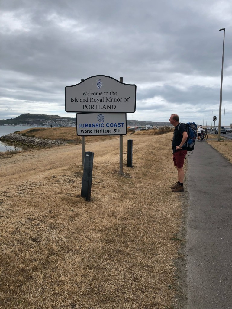
As we walked across the bridge, the wind was really gusting, and I felt the draw and release on my rucksack as lorries passed by. But soon, we were able to get closer to the coastline, though the Path was now sand and small stones-not great to walk on, and dust blew into my eyes; not ideal for a contact lens wearer. Great for water sports though: there were sailboats, windsurfers and parasails out in the harbour. Once on the Isle itself, we headed to the eastern side, and stopped at the Marina café for coffee and cake. Suitably refreshed, we carried on past Portland Castle [as you might imagine from its position jutting out into the sea, there are fortifications all over the Isle] and shortly arrived at our first steep climb. We rested a couple of times on the way up, but I was pleased with how I coped carrying the rucksack weight. I took a pic at the bottom [see Gallery, with the tree and bridge in the foreground] but it’s difficult to convey a true sense of steepness in photos.
By this time, the sun had come out, and so did our hats. Although we were up high, we could only see a view to the west towards Fortuneswell, our view to the east was obscured, but I realise now that we were skirting the prison. The path divided, and we chose to climb our way through an old Battery. Soon after, we could hear the sound of lorries, and realised we must be close to the quarries, source of the white-grey limestone Portland stone. Buckingham Palace is a famous example of a building made with this stone. We had to walk alongside the access road, not pleasant when the vehicles disturbed the dust, but we soon emerged onto the cliff road on the eastern side. What goes up, must come down, time for us to take a steep downward rocky, narrow path, zig zagging closer to the coast. We still weren’t at sea level, but could see rocky outcrops below us on the left, and steep cliffs with the village of Grove atop on our right. By now, we were looking for a place to stop for lunch [we had brought our own sandwiches along for the first day] but the path was still quite narrow, and in full sun, so we had to go on for longer than ideal before we came across two small trees providing some shade over long grass to sit on. We were munching away when my phone rang, and I nearly didn’t pick up as it was just a mobile number, but I’m glad I did, as this was when we received the news outlined above regarding our planned overnight stay. However, we were making good time, estimating we would arrive at Portland Bill around three o’clock, so our plan was to push on, and search for an alternative there.
Physically, all was good at this point. Carrying the rucksacks made our backs sweaty, but the feet were coping so far. Trouble lay ahead though! We approached Rufus Castle at Church Ope where the path descended rapidly to the Cove. It was tarmacked with proper steps, but as they were quite narrow, I angled my body and feet sideways to descend. It turned out that my left knee did not like this one bit, but the twinges didn’t come until later, so I was unaware of the damage at the time. No sooner had we reached sea level, the path went straight back up again, only narrow and rocky now. Rocky was the ongoing theme for a while, whilst we scrambled over rocks large and small, bypassed huge blocks of abandoned stones, and saw disused equipment near areas of former quarrying activity.
I can’t quite remember how my feet felt as we approached the lighthouse at Portland Bill, but my knee was definitely feeling uncomfortable. About a mile back I’d had to stop and take Naproxen for the pain. If you’ve read my earlier post about Ben Nevis, you’ll know that it was worse going downhill for my knees, and twisting as I tackled those steps was a major error. I had my walking poles to take the strain on the mountain, but I’d decided to leave them behind on this leg for weight reasons. However, we had made good time, and rested outside the Lobster Pot restaurant with a pint of cider. We hit our phones, looking for alternative accommodation that would be close to the bus route-the last bus left at five-thirty, so we had a couple of hours. Paul found an AirBnB in Easton, just a room in a house with a shared bathroom, but we couldn’t be too choosy at this stage!
We decided to move inside the restaurant for a bit, and it was when Paul stood up from the picnic table that he had his first physical issue-his hip had seized up, causing him to stagger about a bit [picnic tables are not the best things to sit on after a long walk!]. He had been nursing a twinge in his back from a few days earlier, but the hip is a recurring weak point. Issues that have come with our age are fine on an everyday basis, but rear their ugly heads when the body gets put under stress.
Inside, we sat on proper chairs, ordered tea, and I’m tempted by the Dorset Apple Cake, so I call this my double cake day [Paul opines I’ll be the only person to undertake extreme exercise yet put weight ON]. We followed up with a beer and glass of wine, before catching the bus. It was just a five minute walk to our stay, and after a welcome shower, another five minutes to the pub for dinner. My knee felt a bit awkward, but overall, we were pretty chipper and pleased with our efforts. Day two would be a real wake up call…
LEG 2/DAY 2 PORTLAND TO CHICKERELL

After we left our emergency overnight accommodation, we caught the earliest bus possible to get us back to Portland Bill, but it was still 10.30am by the time we got walking, later than ideal, as this was the longest planned stretch of Leg 2. Paul had taken paracetamol for his leg, and was a tad pessimistic I thought [in fact, he’d posited taking a short cut westwards, but I was having none of it!] whilst although my knee felt normal, I’d downed some Naproxen just in case. The upwards slope from the lighthouse was steady and grass covered, so this pleasant section to start was great for loosening everything up. It was perfect weather again, warm, but not overly so, and soon we had great views from the cliff top along the western side of Portland.
I had begun to sense that the plasters I had applied for protection had ruckled up, and as I didn’t want them moving around chafing my skin, we stopped for more drastic action. The skin wasn’t broken, but I did have some red patches, so I cut off two huge patches from the plaster strip in our medical bag. This felt much better, especially as we were now walking on loose stones and rocks-as well as being uncomfortable underfoot, you get a lot of ankle movement, which just makes progress more tiring. I was keeping voice recorded notes [can’t rely on memory these days!] and I noted that it wasn’t much fun on this bit, but at least we were approaching the end of the uphill section.
By now, we had attained the highest point of the Path on this western side, with a steep drop to the coast on our left and rocky features all around. Suddenly, we came across a small wooden fence partially blocking the path. There was no orange tape as we’d seen yesterday on unusable paths, so a bit of discussion ensued. Our App Komoot wanted to divert us to the right, but as all looked good ahead, we decided to plough on. Big mistake! Suddenly, the path disappeared into a rockfall [note to self; fences are there for a reason] leaving us to scramble up the cliff to our right-from which vantage point we could see there was no easy way down! We had to walk around a little before we found a descent that didn’t look terrifying, and were then on the diversion which led us back onto the Path proper.
We continued along the top of the cliff, [where Paul stopped briefly to sit on a stone throne] all the time looking out for what appeared on Komoot to be an almost vertical drop down. It turned out to be a steep set of steps, leading down to a village, and although this was preferable to the strain of an incline, I could feel blisters had erupted [not on my little toes, but the base of my feet] and I was in some pain. Although we had small Compeed plasters, I needed some big ones, so having descended to Fortuneswell, we headed into the village to a pharmacy. Fortune was actually in short supply here: firstly, the pharmacy was closed for lunch; secondly, the pub we went to for lunch had no food; thirdly, we found a small cafe to eat, but no toilets [ah, yes, the constant worry about where one will next be able to relieve oneself]; fourthly, having purchased the Compeed at the reopened pharmacy and selected another pub back on the Path for a drink/toilet stop, it turned out to be closed. At least they still had tables outside where I could undertake a second patching up.
The Compeed did improve the situation, so with renewed vigour, we set off down the causeway towards the mainland, and near Ferrybridge found refreshments and loos at the Chesil Beach Centre. Just as well, as we were only about half way [Paul estimated about eleven miles for this stretch but in reality it was twelve!].
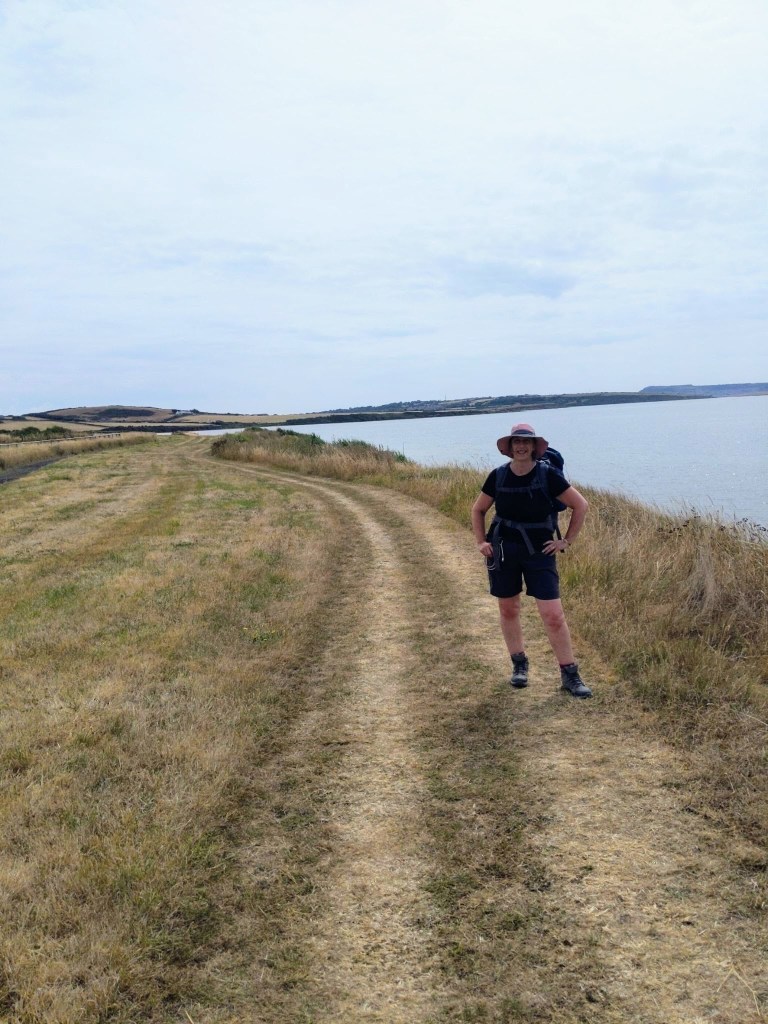
On this western side, we were hugging the shoreline of the Fleet Lagoon, which is the body of water trapped between Chesil Beach and the mainland. Once past a holiday caravan site, there were fields on our right with crops or livestock, and over the water, the shingle forming Chesil Bank. Looking behind us, Portland already seemed miles away, I could hardly believe we had walked from there! The Path was quite pleasant going, very dry, with a short section across the lagoon beach, and relatively level. There was a minor panic when we came to a military area, but there was no red flag flying, so we were safe to proceed. At yet another holiday park, we took the opportunity to rest on the grass, where the photo of me lying flat out was taken! I recorded quite a positive note here, saying how proud I was that, despite both of us having issues, we were on course to cover the final three miles in time for our Airbnb check in time of 6pm. I was falling out of love with my rucksack though-it was lovely to take it off, and horrible to heave it back on.
We rested for a good fifteen minutes before setting out for the final push along very similar terrain, a track alongside farmland, until we had to leave the Path to head inland to our overnight stop-through a field and past some cottages until we hit a road. Just 3/4 of a mile left, but it was uphill. It was at this point I hit the wall. I was struggling now with overall tiredness, as well as the pain from my feet. It came on quite suddenly, one minute I had been ploughing on, the next I felt spent. Still, no choice but to grit my teeth and carry on.
Oh, the joy when we reached our destination, but the pain of waiting while our host explained the necessaries, until I could collapse on the bed. I was now worried about the damage to my feet. It was at this point I made a major mistake-I should have left the Compeed in place [the gel sticks very firmly] but because it had ruckled up, I decided to peel it off, whereupon it peeled off my skin as well, leaving a red raw patch on each sole. [I did take photos, but fear not, I shall leave it to your imagination, dear readers]. I emptied the contents of the medical bag and decided to cover each with a dressing. I only had sufficient tape for one foot, so bandaged the other one. The pub was only a two minute walk away, but I literally hobbled there. My left knee wasn’t feeling too good either. Paul was expressing doubts about our ability to carry on the next day, but there was no need to decide until then. It was a great pub, live music, the England women’s football team playing, and good food. I just wish I could have enjoyed it more!
The walk back to our lodging was just as painful. Would it be possible for me to manage another ten miles, or would we have to give up after just two days? Find out in my next post…
LEG 2/DAY 3 CHICKERELL TO ABBOTSBURY
Now, it has been pointed out that this journey is proving more endurance than enjoyment, and [spoiler alert] the tale of woe isn’t about to let up! However, I would like to stress that it hasn’t all been doom and gloom; we’ve basked in the gorgeous weather while stopping to drink in the stunning scenery, appreciating things that can only be seen on foot, along with the satisfaction that comes from resilience in the face of adversity. We knew this walk would be a challenge-and the blog would be pretty boring if it was all plain sailing! The struggle has given us a lot to think about, and we have a plan for the next Leg. But first, let’s return to Day 3…
In the morning, I was keen to carry on. We had a short test walk down to the nearby shops as we needed to buy sandwiches for lunch, and I wanted more dressings and tape. Although my feet still hurt, the padding of the dressing provided a good cushion for the delicate areas. Actually, I was more concerned about my knee, it was very stiff, but by the time I got back to the house, it had loosened up. As the planned distance for the day was under ten miles, and I had wrapped my feet up much better, we decided to go ahead. We couldn’t give up after just two days, could we?
Firstly, we retraced our steps back to the Path, which was still running alongside the Fleet Lagoon with the sea not visible on the other side of Chesil Bank. Inland, to our right, was farmland, a mix of crops, some still growing, some harvested, and livestock. I noticed there were more walkers on this section [I guess Portland isn’t as popular], including a couple on their way to Studland. They were sitting on the grass near Moonfleet Manor Hotel and after exchanging a few pleasantries, we sat down for a drink break and longer chat. They had spent a couple of weeks each year for the last TEN YEARS covering the Path, and this was their final week, with the end in sight. I asked what they planned to do next, and they replied that with retirement now imminent, they were considering doing it all again, but in one continuous journey! The first bit of advice they had was not to peel off the Compeed plasters [yep, had worked that one out], but the next was that, despite being fit enough to have walked twenty miles in one day, they didn’t carry all their luggage in a big rucksack; they only carried a day pack each and used Luggage Transfers to move most of their belongings between accommodations. They also warned us that the terrain was was quite challenging between West Bay and Lyme Regis. We had thought that keeping clothes and toiletries to the bare minimum would keep it manageable, but oh, how I hated heaving the rucksack back on after every stop, and we were on a fairly level section at this point.
It was too early for lunch just yet, but our friendly couple had advised there was a seat about an hour ahead of us, so off we went with much to mull over.
We began to think this seat was never going to appear, when at last we saw a bench facing the lagoon [called West Fleet at this point] which is used as a birdwatching point. Time to break out the sandwiches and refuel. Though my feet stung with every step, I’d got used to it, and was happy with the fresh dressings and tape I’d been able to put on before setting out. So far, so just about ok.
After lunch, the Path moved inland, and we started coming across stiles-lots of them. Like the proverbial buses, there’d been none at all and all of a sudden, they were everywhere! Now, in our training walks, stiles have posed no problem at all, but with sore feet, a dead weight on my back, and some quite awkward and rickety steps to negotiate [alongside brambles and branches], I found I was having to heave myself up, then the rucksack would suddenly shift its centre of balance over the other side, making it hard work. I could have sworn Paul had taken a photo of me sitting on one of the stone ones we came across, but no. I was obviously too busy climbing over them to get my phone out, so sorry, such a big feature of the day has no pictorial evidence. [I did however record the branch across the track where Paul whacked his head-see gallery!]
I think I’d been coping quite well up to now, but things were about to take a turn for the worse-we had gained some height and the track went along the cliff top, but it was very narrow; each footstep had to be directly in front of the other rather than hip distance apart, and my knee didn’t like this one bit. It is only a subtle difference in movement, but it reignited the pain in my left knee, and here, for the first time, I let Paul carry my rucksack [oh, the shame]. From here on, it was a real slog, exacerbated by the fact that I really needed a toilet stop. Paul, of course, could just approach a hedge, but when I tried to find a suitable spot, I was easily visible from other fields, so chickened out.
Faced with a steep hill [with yet another stile atop it] Paul took my pack again, but soon afterwards, we could at least see the village of Abbotsbury ahead, but with another steep downhill section this time I had to go very slowly on account of my knee. It’s fair to say I was struggling now, but at least we had reached the Swannery-we could sit down, have a cup of tea and slice of cake, and go to the loo! This break was vital to give me the ability to cover the last three quarters of a mile to the village. Tonight, we were actually staying at The Ilchester Arms, so we’d only be walking downstairs for dinner! To be honest, the room was a bit basic, and the shower wasn’t great, but the food was good. I wasn’t the only one who’s body was feeling battered-my voice note records that after sitting for a bit, Paul’s legs went all wobbly when he stood up. We had a serious conversation about carrying on-today’s walk had pushed me to the limit and the terrain wasn’t getting any easier. As it was too late to cancel our planned accommodation, we decided to get the bus to West Bay and have a day of rest.
The next day, we arrived at West Bay, dumped our packs at The George, and went for lunch. I was really struggling to walk any distance at all though, even meandering about the village was horrible. At least the pub room was excellent-a lovely big bed and a proper bathroom, including an actual bath, so I could have a proper soak. My feet were in a sorry state though, so after a brief discussion, we decided to abandon Boomerwalk, suck up the loss of the cost of our Lyme Regis stay, and go home.
On the way back, I had a sense of crushing disappointment; we’d had to give up after just three days walking, and our bodies had taken considerable punishment. One positive aspect though- the original impetus for the Walk, my broken heel, had not been an issue at all. So, undeterred, we were already making plans for Leg 3. Firstly, we realised that we need to keep the daily mileage to an absolute maximum of ten miles, ideally about eight or less. Secondly, we decided to abandon the rucksacks and try using the luggage transfers. Thirdly, I would take steps to protect my feet [I’ve since bought silk sock liners and gel insoles, recent test walking is promising].
Another Leg has now been planned and booked up-we start from Abbotsbury on 19th September with Lyme Regis as our goal, over three nights. We’ve gone from being ambitious to fairly cautious, and I’ll be posting about our progress later this month. Meanwhile, we plan to cover the stretch either side of Worth Matravers on a couple of day hikes. Cross your fingers for less woe, and more go!
LEG 3 DAY HIKE WORTH MATRAVERS TO SWANAGE

We planned this day hike to cover a bit more of the Path without an overnight stay, and also to check out my anti blister measures; I thought it might be a rather uneventful day [oh, how sweetly naive I can be] but I should know by now that a surprise or two is par for the course!
We drove to Swanage and parked up in the main town car park, a short walk from the bus station. We each carried a small rucksack with medical stuff and waterproofs, as we were expecting a shower or two, but the forecast was predominately for sun and cloud [oh, what optimism].
It was only about twenty minutes on the bus to our stop at Acton-we now had a two mile walk just to reach the Path. It took us through the hamlet of Acton, along a track between fields, with glimpses of the sea to our left, before hitting the road just north of Worth Matravers. In the village we turned off into a grassy area where I got Paul to take my photo [see gallery] as we were both feeling pretty chipper! We soon came to a stone stile, which we negotiated with ease. Oh yes, things were going very well. But we had yet to reach the coast; a set of steps took us to a lower level, and finally, we hit the Path.
This took us uphill along the cliff top; the coast here is quite different to the lagoon and shingle bank we had experienced west of Weymouth, here there are craggy cliffs with mostly sheer drops down to interesting formations at sea level. Not much further along, we found a rock seat for a water and banana breakfast break. You can see from the photo in the gallery that the sky was turning “moody”- lots of cloud cover with colours ranging from white to an ominous dark grey. In fact, we then had a very brief shower where we whipped out our waterproofs, but I was too warm with my fleece on underneath it, so I resolved to have just my outer coat on if we got another shower.
We had just passed the Dancing Ledge rock formation when the next downpour occurred, and actually, it was sleet! My coat did a good job of protecting my top half, but the water ran off my back straight onto our shorts. Paul’s turned from red to burgundy, my backside was just sopping. It was at this point we managed to stray from the Path-we just kept following the marked track, heads down, but it had actually forked, and we should have taken the other route [hey, it’s not really a proper walk if we don’t get lost]. It meant that for a while we were crossing muddy moorland parallel to the muddy Coast Path. Our way was blocked by a quagmire, but Paul found an alternative way round that necessitated scrambling through brambles and gorse. A few cuts were an acceptable price to pay to avoid the risk of potentially falling into a mud bath [I could cope with being soggy, but not muddy as well!]. When the sleet let up, I did notice that my wet legs had a streak of blood on my right side and mud marks on the left [the clumps would fly off our walking boots] and I collected another clump as I climbed over an unusual stile with two poles across it. Paul made a right pig’s ear of getting over this one, he seemed to have trouble getting his leg high enough to clear the pole and sort of stumbled his way over! [See the action replay in the gallery!]
When we could lower our hoods and see better once the rain/sleet had eased, we realised our error route wise, as we could see the Path below us, but it looked as though we could rejoin it once we hit the edge of Durlston Country Park. It was a jolly steep way down though! Thankfully, it was grassy, so we didn’t slip as we descended. The Path itself was quite muddy and I slid about a few times-the mud was still attaching to our boots in clumps which would suddenly fly off as we walked. Every so often, we’d stop to wipe off the sides on some grassy bits. Ahead, we could see Anvil Point Lighthouse, and as there were a few rocks, we sat there for our picnic lunch. I felt thoroughly bedraggled, with my wet bottom, wet socks [my lovely flexible, breathable boots are not waterproof, hey ho, you can’t have everything] bloody, muddy legs and straggly hair. Despite this, I still felt quite positive-once you’re wet, it doesn’t get any worse, we were making good time, and, most heartening of all, my feet felt good. The gel insoles were evidently softening the impact, and we were only carrying small backpacks.
After lunch, the sun came out, and as we walked past Tilly Whim Caves towards Durlston Castle, my shorts started drying out on the front at least! Here the Path was well maintained and easy to walk on as it forms part of Durlston Park. We didn’t detour up to the castle, but did stop to admire the stone sphere with the world map engraved on it. Just past there, the Path ascended steeply, but we got a good view of Peveril Point, the promontory to the west of Swanage, which would be the final part of today’s walk. First, we had to get out of Durlston into the outskirts of Swanage. The rain showers continued off and on, but not as heavily as before. By the time we got to Peveril Point, the walk had turned into a bit of a slog-the last mile or so is always tough! For the final section we were right down at sea level now, walking past the fishing boats on the edge of the Bay with the sea lapping beside us. We fancied a drink as we reached the town, but with a pair of soggy bottoms, we couldn’t really sit inside. However, a kiosk with outside seating did the job, I had a cider, Paul had a pint, and we felt it was well earned!
Whilst the weather had spoiled the enjoyment factor of this walk somewhat, most important of all, was the fact that my feet had coped. A relief, considering we had already planned and booked our next few days consecutive walking.
