LEG 4/DAYS 1-2
DAY 1 ABBOTSBURY TO WEST BAY

I can’t say as the activities of the Royal Family have impacted my life particularly to date; a mug for the Jubilees, and the odd Bank Holiday. But Her late Majesty threw a spanner in our well planned works when the State Funeral was arranged for the first day of our next Leg. We were due to stay at a pub in Burton Bradstock, but they informed us they would be closed for the day! [I expected shops and businesses to close, but pubs are usually open on major holidays.] This meant that, yet again, we were frantically searching for accommodation at short notice. With no other options in that village, we booked a guest house in West Bay, adding a further two miles [though we could get the bus if desperate] taking us up to our maximum of ten miles for the day. I just hoped that our fresh legs and extra foot care precautions would be up to it.
The initial travel arrangements went smoothly: taxi to the station, train to Weymouth, where we were met by the Luggage Transfer guy to relieve us of our suitcase, then a short wait for the bus to Abbotsbury. There were public toilets in the village, nice to be comfortable at the outset! It was a glorious day for September, sunny and warm, so it was a shame we’d barely been going ten minutes or so, when a somewhat tetchy exchange ensued. We had reached a babbling brook [a daily feature on this Leg, look out for them in the gallery pics] where I knew the Path diverged, one heading directly south to the Swannery [where we had come from on Leg 2] and the other south west to the coast. I wanted to take the latter course, but Paul insisted Komoot was directing us the other way and basically ignored me. Fuming, I started a mini rant about how many times I’ve been right, yet overlooked, but it’s difficult to argue with an App! Both routes ended up in the same place, so we moved on, literally and figuratively.
At this point, marked by an old pill box lookout, we could finally see the end of the Fleet Lagoon, [factoid from Paul-this was where the Dambusters practised dropping the bouncing bombs in World War ll] but although the high bank of shingle had gone, we hadn’t reached the end of Chesil beach proper. Now we had to walk across the actual shingle for a short way, up to a car park and cafe. The cafe was closed, a pity, because it is one of the places where you can get your Coast Path Passport stamped, however, the toilets were open! After this brief stop we were back onto the shingle beach, which was absolutely leg sapping with our feet sinking deeply into the stones with every step. Our lunch stop was at West Bexington, but anticipating the cafe there being closed, we had brought our own sandwiches which we enjoyed sitting on a wall by the car park. This place also had toilet facilities. [Sorry if I sound a bit obsessed, but toilet provision can be sparse along the Path-these things matter when one is of a certain age!] We asked a Walker approaching us how far he’d walked along the beach to which he answered “thirty seven miles”-a joke, but we did blanch when we saw the stone marker detailing five and a half miles to West Bay. We set off, thinking this would be a major slog, but half a mile along, we saw a sign directing us to the summer detour path. This takes you through grassy fields, and despite recent rain and thunderstorms, the path was dry and rock hard, and much easier to walk on than the beach. We made good progress, and got to Burton Bradstock before two o’clock. Therefore, it was a simple decision not to get the bus, but carry on walking to West Bay. My voice memo notes that my knee had started twinging, but my feet were good and Paul said he felt wonderful! We moved from sea level to a cliff top barely noticing the climb as it was so gentle. Following a descent, my knee got worse, so I actually put on an elastic knee support that I bought a few years ago when my other knee was playing up. It also helped that we had brought along a walking pole-now that we were only carrying a day backpack each we could manage the weight of this. We reached the iconic sandy cliffs to the east of West Bay, and decided to walk along the beach rather than along the cliff top, which had an ascent then steep drop into the town. The beach here was a mix of sand and stones, but had a rocky ledge we tried to stick to most of the time. This was the point where I stopped enjoying the walk-this was a slog, and my knee was hurting to be perfectly honest. Most frustrating, as my feet were in good order. Still, I had a lovely soak in the bath and felt ok by the time we set out to find dinner. This wasn’t as simple a task as you might imagine, as only one pub, the Bridport Arms, was serving food. They found us their last table, then, because our dessert order got overlooked before the kitchen closed, they didn’t charge us for any of our drinks (g&t, beer, bottle of wine, two coffees). Very generous!
DAY 2 WEST BAY TO CHIDEOCK
Because of the extra distance covered yesterday, today’s walk was relatively short, we anticipated arriving at our AirBnB stop in Chideock around two o’clock. We set off at ten thirty, and again missed a Passport stamp as the Discovery Centre didn’t open until eleven o’clock [aarrgghh].
It was a steep climb out of West Bay, followed by a series of ups and downs. I was wearing my knee support, but decided to take Naproxen as well when we got to Eype Beach where we stopped for a water break. It was here we saw our babbling brook of the day. Excepting the beach itself, the terrain was mostly grassy fields, and a feature of this four day leg was the vast number of kissing gates, as opposed to stiles, easily negotiated however, now we were no longer carrying full rucksacks.
The ups of our walk afforded us lovely views inland and eastwards. On the horizon to the east, the Isle of Portland was a distant, hazy, grey blob, and it seemed extraordinary to think we had covered the ground from there on foot. Westwards, we were confronted by the peak known as Golden Cap, the highest point on the south coast, which we would face the next day [gulp]. I hope my gallery photos do the scenes justice, and if any readers are tempted to visit the area, I can say that there are many, many campsites available! Meanwhile, for the first time, one toe on each foot was beginning to burn, so we took the opportunity atop Thorncombe Beacon to stop for some blister prevention, a Compeed plaster wrapped over with zinc oxide tape [hey, you can’t say we haven’t learned something from our previous experience].
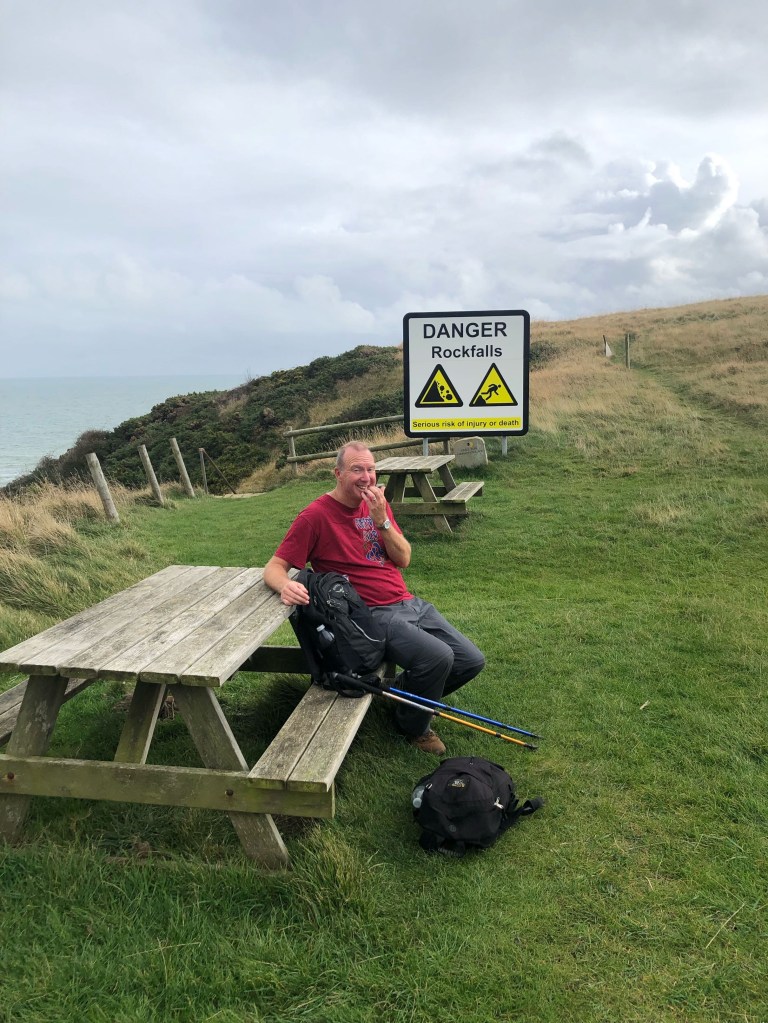
The next challenge was heralded by Paul’s exclamation “Ooh, cows!” Yes, we had to walk through a whole herd directly across our path, and though he’ll deny it, Paul was definitely a bit twitchy [years ago, walking our dog, we were pursued by a herd of cows, which, to be fair, was a little nerve wracking] and although the older cows ignored us, the younger ones were eyeing us up, evidently unsure about us. We skirted around them safely, and soon we could see Seatown and the Anchor Inn pub ahead, our planned lunch stop [also the first opportunity for a loo break today, as I said before, provision is variable!].
A ploughman’s and two gin and tonics later and we were off for the final stretch. Our hosts at the Castle in Chideock were very welcoming and we had opted for their terrific home cooked dinner that night, so we had a great rest all afternoon and evening [there was also another long soak in the bath for me, very restorative] which was great news for my complaining knee. It hadn’t been bad enough to stop me walking, just to stop me thoroughly enjoying the process. The elastic support and tablets had mitigated the worst, but trepidations abounded with the most challenging section of this Walk to be covered on the next day. I would never have guessed that I was in for a big surprise…
LEG 4/DAYS 3-4
DAY 3 CHIDEOCK TO CHARMOUTH
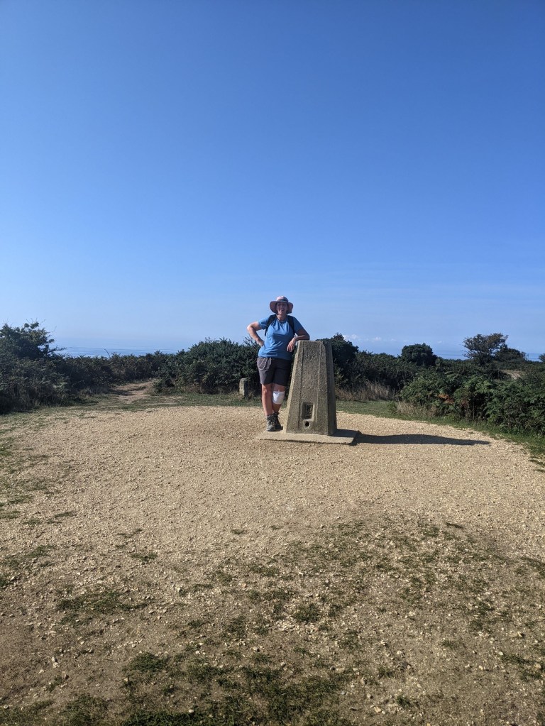
I look pretty relaxed and casual leaning against the trig point atop Golden Cap, which doesn’t really convey just how GOOD I was feeling; although I’m wearing the knee support, I didn’t need it. For the first time since I hurt it walking on Portland in the summer, my knee felt normal again. The twinging and sometimes outright pain had been ruining my enjoyment of the walks, so it was a wonderful surprise to set out on this third day and focus on the actual walking rather than my body! I had felt positive as we set off from Chideock, the weather was warm and glorious as a summer’s day, my blisters were well protected, and the only blip had been Paul breaking his sunglasses! We deployed the sun hats and set off for the coast.
As you might expect from a coastal path, most of it is quite open and exposed, but this morning, we were slightly inland. We emerged from a small area of tree cover into a grassy field to get our first sight of Golden Cap, the highest point on the south coast, peeking above an area of woodland. Going through the woods was rather pleasant, walking on a good path in the dappled shade. It wasn’t long however before we faced our first uphill challenge, a series of steps. It has proved difficult to capture steepness in photos, but I’m pleased with some of today’s collection, so check the Gallery. One of Paul’s oft repeated complaints is the lack of seating along the Path, but we had no less than two benches to rest on during this ascent, the first at the top of the steps, the second after climbing up a grassy slope. From here we had a stunning view of the beach at Seatown, and, on the horizon, the misty grey outline of the Isle of Portland jutting like a pier into the sea. It seemed quite extraordinary to contemplate that we had walked the entire coastline from that point.
A little further on we reached the peak of Golden Cap, marked by a photo at the trig stone marker. Our view west had been blocked by this hill up to now, but at last we could look both backwards to the path travelled, as well as inland and ahead to Charmouth and Lyme Regis. Despite plenty of other walkers about, the scene was one of calm and stillness, even the sea below us was languid, only able to conjure the smallest of ripples. But with plenty of distance still to cover, we didn’t linger for long, we started the descent, more uneven steps [steps were very much a feature of the day] and steep grassy slopes. Is it easier to go up or down? Well, ascending does get my heart pumping, my breath gasping, and I need breaks to recover. Going down, the strain is all on the knees and calves, and on a slope, the toes get squished in your boots. For me, now that my knee is better, going down is easier, it had been agony heading into Abbotsbury in the summer!
Half way down there was yet another bench, so we took the opportunity to sit down and have our lunch, while feeling slightly guilty about hogging the seat as we watched a series of walkers toil up towards us!
The next section was up and down a series of dry grassy fields, so good terrain to walk on, until more steps as we approached Stonebarrow Hill. By now, I was very hot and sweaty; although I wasn’t in pain, it was still hard work! The good news was that the final mile into Charmouth was pleasant going. There isn’t a lot at the beach; a kiosk cafe, fossil shop, Beachmaster’s office, small heritage centre and a few beach huts. Time for a well earned ice cream and coffee. A couple we chatted to en route had suggested we walk along the beach to Lyme Regis, just checking the tide with the Beachmaster first [strongly discouraged in the guide book because of the danger of being cut off] but visually we couldn’t see the route properly, so decided we would take the inland path next day. We were quite charmed by Charmouth – it’s very low key compared to Lyme which made it all the more pleasant. Naturally, we had time to stop for a drink at the local hostelry, before making our way to our AirBnB booking for the night.
DAY 4 CHARMOUTH TO LYME REGIS
We gave ourselves just a relatively short distance to cover for this section as we had to allow time to travel home, but we still couldn’t manage to have a day without some sort of mini drama [is it just us?].
It all started straightforwardly, if steeply, enough with a steady climb through the village and then past some rather nice houses that have fabulous views over the bay [slight twinge of jealousy here] until we emerged into some long grass on the edge of a golf course. Here we were faced with two path options and a signpost. The sign directed us to Lyme Regis on the right hand path, but Paul referred to Komoot and said that the Coast Path was left. After following this route and skirting the golf course, we saw a sign which said “no through route to Lyme Regis, follow coast path” which totally confused us, as we WERE on the coast path [or so we thought]. Paul was reassured by Komoot, but we continued with some trepidation.
A little further on we veered away from the golf course onto a well marked path through woodland which seemed promising, but after Paul checked the App, we realised we were actually walking north of where we should be and our current route was taking us to a farm. To our left was a small bank and ditch with another bank and plenty of trees and undergrowth alongside. Luckily, the ditch was dry, so Paul climbed across, pushing his way through the foliage, till he was about twenty feet south of me. He then called me over, saying he had found the Path. I managed to clamber across the bank and ditch, and from then on, it was easy going through the wood. We saw another sign where “Coast Path” had been blacked out – we realised that the official Path had been diverted at the start of the golf course, and it was our good fortune that we had been able to scramble our way across the ditch to follow the old route. Bit of a black mark for Komoot, not being up to date, but we made it!
At the exit kissing gate we had a nice view of The Cobb and then an easy stroll into Lyme. We headed for the Rock Point Inn, not just for a drink, but because I was finally going to get my first stamp in our Coast Path Passport!
We felt very happy as we travelled home; the luggage transfers had worked beautifully, we’d completed each stage successfully, and my knee was now better than at the outset! It all gave us confidence to plan our next stretch, which I can reveal we have now completed. There was more drama [of course] and some extreme weather, so look out for the next instalment, coming soon!
LEG 5 DAY 1 KINGSTON TO KIMMERIDGE

It was the first sign of (human) life we’d seen since getting off the bus in Kingston-the Chinook helicopter passed directly overhead, and I couldn’t help wondering if the pilot was thinking something along the lines of “what the hell are those two doing out on the cliff top in this weather?” The answer of course was that we had carefully planned our next section of Boomerwalk, booked all the accommodation, and it was too late to cancel even though the weather was forecast to be, shall we say, a little inclement?
We had started out thinking things weren’t going to be as bad as they looked; we had taken a taxi to Bournemouth Square to catch the bus to Swanage, and on arrival handed over our suitcase to Dave from Luggage Transfers, who wished us luck. At this point, the sun was shining with nothing more than a gentle breeze blowing as we waited for the next bus to take us to our stop in Kingston. We said a friendly farewell to a couple we had been chatting to on the bus, and cheerfully headed off through the village towards the coast, feeling positive about the modest mileage and relative ease of the terrain ahead. We didn’t see another soul until our taxi driver picked us up at Kimmeridge Bay. She found us sheltering under the roof of the toilet block, but I don’t know why we bothered as we were already thoroughly sodden and bedraggled. I was fairly desperate for the loo, but resisted using the facilities because at least I was only wet on the outside; having to get half undressed to go, would, I reasoned, make me even wetter, so I decided to hold on until I could just strip off completely at the hotel. So what happened in between? Read on, my friends…
I took a photo of Kingston church as we walked along the road to the coast, past a row of cottages. All was peaceful, but as the road became a footpath, the wind began to pick up, and the sky was a moody shade of grey. Our first hazard was a stile leading into fields of sheep [cue some gentle ribbing of Paul along the lines of how relieved he must be they weren’t cows] but there was still a proper path for us to follow, though it was utterly splattered with sheep poo. My ears started feel the cold headwind, so I dug out my Nordic style woolly hat [what an excellent last minute decision to pop it in my backpack] and as we joined up with the Coast Path at Chapman’s Pool [not a pool but a small cove-we’ll get a better look at this when we cover the final missing section on a day walk around St Aldhelm’s Head] we suddenly felt the full force of the gusting wind. Unlike our last walk, when the sea was like a pane of glass, today it was roiling and noisy, with multiple waves surging up to the shore, and the horizon barely visible as the greyness of the sea and sky merged. We turned right, heading west, to be immediately faced with a steep flight of steps cut into the grassy slope – there was some shelter from the cliff top initially, but when we came to a break in the cliffs, the force from the wind was tremendous. Our weather app indicated a wind speed of roughly forty five miles per hour! My voice memos are almost drowned out by the sound of it. Climbing was hard enough, but trying to maintain my balance at the same time was the most leg sapping thing we’d done since traversing the shingle on Chesil beach. We had to take three breaks on the way up [“182”, indicating number of steps, was scratched into the top stone] and normally would rest again at the top, but we were very close to the cliff edge and totally exposed to the fierceness of the gusts, so there was no choice but to push on, exhausted.
There was a brief respite when the path took us slightly away from the cliff through some brambles and small trees, and although there was a series of more steps, both up and down, there was a rickety hand rail to help. But it wasn’t long before we were back on the cliff top, in the gallery you’ll see how exposed and close to the edge we were; not a problem on a lovely day, but I admit to being quite concerned at times, my only consolation being that the wind was coming from the sea inland. The opposite way would have been truly terrifying. As I said to Paul, I’d rather be blown into the barbed wire fence than off the cliff!
The only other signs of life were the many seabirds flying to and from the black face of the cliff behind us, a rather strange anomaly as the cliffs are predominantly white on this stretch of coast.
By now it was lunchtime, but it was difficult to find a suitable place to stop – no chance of any benches on this remote section, nor was there any shelter. In the end, we decided to sit on the ground with our backs to the sea, leaning against one of the small stone markers regularly placed along the Path. Crisps had to be held tightly on the journey from packet to mouth, otherwise they would have been whipped away in a trice, there was no let up from the buffeting of the gusts. It was a pretty miserable experience, our only consolation being that the promised rain had yet to appear. However, as there had been plenty of rain in the days leading up, as we continued it was inevitable that we would face the effects of the downpours somewhere along the route, and sure enough, one part of the track could be described as a mud skating rink; indeed, I did slip when my bobble hat got caught on some brambles and I pricked my finger on the thorns as I reached out instinctively. But that pain was nothing compared to what happened next; suddenly, our faces were pelted with multiple sharp stings. I still don’t know if it was hail or the wind whipping up small stones from the ground, but it was vicious. [With incredible fortitude] I stopped to take the photo of Paul with his waterproofs blowing out, [his stiff upper lip is failing to convey the full horror of the moment] but then it was head down and plug on. My voice memo uses the words “relentless” and “exhausting” for the next section, so it’s miraculous how chipper I look in the photo with Clavell Tower in the background! [Hey, I can do stiff upper lip as well as the next man.] Maybe that’s because we were still dry, but at last the promised rain poured down [as if we hadn’t suffered enough!] and in a short space of time we were feeling pretty sorry for ourselves. A downward set of slippery steps [I went down backwards to be safer] was the final hurdle on easily the worst weather we’ve had so far. Waterproofs had protected us from the worst, but we were still pretty soggy and the sight of the car park at Kimmeridge Bay was heartening. Not quite as glorious as arriving at the Bankes Arms Hotel in Corfe Castle though! We reflected on one of our most difficult days so far, outside of physical issues. Actually, other than the sheer effort involved, the body was in good shape, no knee issues or blisters. It really wasn’t a good day for walking, but yet again, we felt a sense of achievement. The next day was to see much improved weather, but the Lulworth ranges would challenge us in a quite different way, so look out for the next instalment.
LEG 5 DAY 2 KIMMERIDGE TO LULWORTH
“I feel so inadequate!” I quipped at the young man jogging [yes, jogging] up the hill where Paul and I had stopped for a [second] rest. This was the second of three steep ascents today as we traversed the Lulworth Ranges, a section devoid of anything but a few tanks and stunning scenery. The Ranges are owned by the Ministry of Defence and used for firing practice, but the public can access the area most weekends and holidays. [This was where Natalie came unstuck at Lulworth when she was faced with locked gates. Now that we’ve walked it, it’s a really tough eight miles – as she was already so tired, I think in retrospect it was good that she couldn’t continue, we might have had to send out a search party!]
Having first bought rolls for our lunch from the bakery in Corfe Castle, we began the walk where we ended the day before; the toilet block at Kimmeridge Bay. It was dry, and the wind, though still breezy, was nowhere near as strong today. We had a bit of a false start when our path took us into some undergrowth, but we were only thirty yards or so off piste, and we picked up the correct route. The first feature of note we passed was the oil field – its quite small, barely a football pitch in size, with a single pump and a few sheds, not a person in sight, and eerily quiet. Just a little further on we saw the fence and gate marking the boundary of the Range, and inside plenty of signs warning us not to stray from the path marked by yellow tubes [no excuse for getting lost today]. Actually, if you were judging by the number and variety of warning and danger signs we passed, you could say we were risking our lives! It didn’t feel especially dangerous though; the terrain was grassy and dry, the weather was comfortable, and after yesterday’s trials, we were optimistic for a good day’s walking.
Inland, aside from some sheep, the grassy fields were relatively featureless, but the coastline was something else; a series of bays and coves edged by jagged white cliffs making a “v” shape by plunging steeply downward before ascending again. I had the walking poles to assist on the uphill sections, and I confess I accepted Paul’s offer to carry my backpack on the steepest bits. [I had managed well with it in September, but because I now had a coat and waterproof trousers, it was heavier than last time.] My pack was about to get lighter though, as we decided to wear the waterproofs – ahead and out at sea, we could see a blue-grey cloud with the tell tale downward streaks of rainfall, so we thought we’d get ahead of the game. Oh, how foolish we were to think we could anticipate the vagaries of British weather, our smugness dissipated as swiftly as the rain cloud travelled northwards away from us, and, in short order, I was boiling hot! We had descended to Worbarrow Bay at this point, where we made the decision not to take the mile long round trip to visit the abandoned village of Tyneham [the villagers were evacuated during WWII for the duration, but the MoD never gave it back. We figured it would make a nice motorbike trip out instead]. I sat on one of the ricketiest picnic tables I’d ever seen [no warning sign for this, eh, MoD?] so we could remove our outerwear in preparation for the steepest and longest climb of the entire walk to date. Even young people were resting half way! Ah yes, in contrast to the day before, plenty of other people were out and about enjoying the area today.
The slope was so steep, it wasn’t even that comfortable to sit and rest. Paul took a photo of me catching my breath, see the gallery [now with added captions!]. The yellow markers were now serving as targets to reach before stopping for a break. I took at least three breaks.
At the top of the hill is an Iron Age Hillfort named Flowers Barrow, from where we had a great view inland towards Lulworth Castle. We decided to stop here for lunch, a vastly more comfortable experience than the day before, though still a tad chilly and breezy! I thought we’d broken the back of the walk at this point, just a descent into Lulworth, but there were two more ups and downs to negotiate, the next one I referred to above, where we were passed by the nonchalant jogger. Around this time I began to feel a blister coming on, so sat down for a medical time out, whilst chatting to a dog walker. She advised us that she came from Lulworth on the cliff top above the Cove, but that the path was very muddy and dangerous, so she recommended taking steps down and walking along the beach instead [as we were to discover, this route also had its hazards].
With my toe wrapped up, we continued on towards Mupe Bay and Cove, where you can see a picturesque series of rocks projecting into the sea. This marked the end of the serious climbs and descents, the poles had really earned their place, and Paul had [heroically] carried my pack up the worst bits. The weather had another slap in the face for us now, when, out of nowhere, it began to rain! I must say, I was pretty nifty, untying my fleece from my waist, pulling out coat and waterproofs from my pack, and getting them on me before I got too wet. This was a lesson learned from the “soggy bottom” walk [never too old to improve].
The rain didn’t last for long, it had stopped by the time we reached the gate marking our exit from the military area, but it was sufficient to cause problems for the final part – as we reached Pepler’s Point with the view of Lulworth Cove ahead, the track turned into a mud bath, and even using the poles, my feet were slipping and sliding. With foliage on either side of the path, we had no choice but to step into the mud carefully. At one point, I did lose my balance and Paul grabbed my arm, which prevented me from completely falling backwards, my pack took the worst of it. It was with some relief [shortlived, in hindsight] that we located the left fork and steps to take us down to the beach, but we were stymied when the last step was still some six feet above beach level. [See gallery photo with special edit!] We looked carefully at both sides but Paul just went for it in the end, he managed a few steps before sliding the rest of the way. I threw down my poles and pack, and decided to crawl down on my knees, feet first – but half way my right foot just slid away from me, so I was in danger of doing the splits vertically until Paul caught me! My thigh twinged and I hoped I hadn’t done any damage, because my knees had been tickety boo despite the up and down strains of the day. Still, the end was now in sight, civilisation [the pub] beckoned, just the beach to traverse. It was covered with deep piles of slippery seaweed, not quite as dangerous as the mud, but I took it steadily – that is, until we reached a narrow part of the beach where the tide was almost cutting us off, and as the water receded, I scuttled my way across the seaweed and shingle. I felt pretty bedraggled and dirty, but the public toilet had a large sink, so we employed the Boot Buddy and cleaned off our boots, so we could go in the pub without feeling too embarrassed.
As I reflected on the day over a gin and tonic, I was pretty happy. Yes, it had certainly been a challenging section, but we had coped well with the difficult parts by resting, and my physical damage was limited to a single blister and a slight twinge. It was wonderful to experience such an unsullied part of the coast, [I hope my pics do it justice] and I felt really positive about the next two days ahead.
LEG 5 DAYS 3-4
DAY 3 LULWORTH TO OSMINGTON MILLS
Here it is at last, the final instalment covering our last expedition, delayed by our busy December and New Year. I know you’ve all been desperate [I wish!] to find out how we got to the end.
First, let me remind you [and myself] where we had reached so far: the previous day had been spent crossing the Lulworth military range, up and down a series of steep hills, followed by rain showers and a mud slide into Lulworth Cove. We had booked an AirBnB in West Lulworth, a bedroom and bathroom in a house owned by a very welcoming lady. Our waterproofs were quite muddy so she put them in a quick wash for us, as we anticipated needing them the next day. However, the really bad weather occurred overnight, a full on thunderstorm, leaving us to set off the next morning amid some pleasant sunshine.
The day began with an argument between Komoot, our walking guide App, and myself [to be honest I can’t actually remember the details now, but my voice memo states that I was right!] and we ended up exiting the village via a long slope of stone paved steps. Alas, we were not done with steep ascents just yet! However, once at the top of the steps, it was a pleasant stroll to Man O’ War beach, and on to the well known landmark of Durdle Door. The Sunday sunshine had enticed plenty of people out, despite being late October [we Brits evidently can’t resist a well known natural landmark] though only a few of us hardier types were actually walking the Path!
At the top of the next ascent, it was time for a banana and water break, and I also needed to take care of a looming blister. Yes, despite all our mitigating efforts, they are still an occasional hazard- I applied a big Compeed plaster and I recorded that my toe sunk into it on the ensuing descent, the charmingly named Scratchy Bottom [bottom being Old English for a valley] so I was feeling fairly comfortable afterwards.
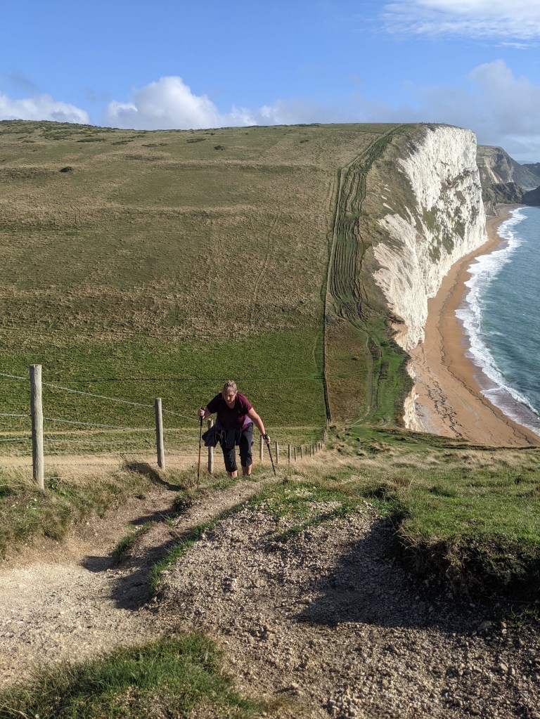
We were experiencing a sense of deja vu regarding the terrain at this point, with a continuation of ups and downs like yesterday. Paul was still taking my backpack on the steepest stretches whilst I employed the walking poles [see main pic!] to help me, though you do have to be careful not to dig them into a place that can slip. Most of the time, Paul and I carried a pole each, and he has evidently seen the benefits, as he asked for his own pole for Christmas! For my present, I asked him for a new backpack-I’ve chosen one that arcs away from your back with a breathable cover to reduce the likelihood of getting that horrid, sweaty wet patch on your back [TMI? Sorry, but this blog guarantees to cover ALL the issues, however icky] and slightly smaller in size.
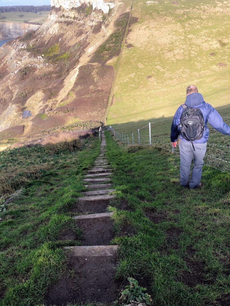
At last, we came to the final ascent of the walk, much longer than before, but less steep, and I carried my own pack up this time, so I’m pleased to say I was still in perky form, despite the challenging hills. At the top, we saw a marker pointing out the old smugglers’ route down to the coast [see gallery] and we were heading for The Smugglers Inn as our accommodation for that night, right by the beach at Osmington Mills. It was a popular landing spot for those engaged in smuggling, though it was rife along the entirety of the Dorset coast during the 18th and 19th centuries. We didn’t have to tackle the hazardous way, but stuck to the cliff top till we reached an old pill box at White Nothe, where we stopped for lunch, and the first view of our final destination next day, Weymouth. I noted that it was one o’clock, we had just 2.7 miles to go, and the sun was still shining. Too good to be true? It wouldn’t be a walk without suffering of some sort!
The only issue with the terrain was that we were now walking on a muddy path very close to the edge of the cliff, but this was soon passed by and onto grassy areas followed by woodland with a couple of bridges to cross, and as we approached Ringstead, either well paved paths or roads. If the weather had continued to look good, all would have been nice and easy, but we could see rain carrying clouds ahead. Paul decided that if we kept up a sharp pace we could get to the pub before the rain, so I ended up describing this section of the walk as “relentless” in my voice memo. Although we were over the worst of the hills, there were still tiring sections where we would normally have rested, but we pushed on. We were in sight of the pub, about a quarter mile away, when the rain caught up with us, resulting in a, shall we say, frank exchange of opinions between Paul and myself as to whether we should stop to put our waterproofs on, or continue. Irresistible force met immovable object! I resolved the disagreement by simply stopping and getting my coat out, and was glad I did, as the rain was heavy enough to be unpleasant. We got to the pub at quarter past two, so had covered the last stretch in just an hour and a quarter. I really earned that gin and tonic! I can highly recommend the pub, either as a place to stay or eat, although we had pushed the budget to stay there for the sheer convenience of being directly on the Path. Enjoy the gallery pics, and keep scrolling down for a short account of our final day.
DAY 4 OSMINGTON MILLS TO WEYMOUTH
The rain absolutely lashed down overnight, so yet again, we missed the worst and had the prospect of a dry day ahead. This last day promised to be a doddle; no serious hills, pleasant terrain, and a mere five and a half miles to the centre of Weymouth. Prepare to be shocked now, as there are no tales of woe! No medical issues, no getting lost, no adverse weather or terrain [no arguments!] it was a lovely wind down to this section of the Walk.
Our route took us through woodland for a change, followed by a grassy track, where a little further on we came across Osmington Bay Camp. This was something of a rite of passage for our daughters, their first school trip staying away from home, in the last year of First School, aged nine. Activities included abseiling, crawling through tunnels and hiking, as well as indoor challenges. Natalie had snow during her stay, Holly had mud, and they both had a great time!
At the eastern end of Weymouth lies Bowleaze Cove, where a small funfair is situated; the Path took us right through it and beyond into a park, at the top of which we rested and looked back at the Riviera Hotel, a rather attractive 1930s art deco building. A little further on, we reached the final stretch, the entirety of the promenade alongside Weymouth beach. The weather was bright and breezy, as were we, with the prospect of a leisurely pub lunch before collecting our luggage at the station and catching the train home for a celebratory dinner and drink! After all, we had started the walk in terrible conditions, negotiated the most challenging ascents so far, with no facilities en route, and coped with everything.
COMING UP
I just hope our bodies can deal with the long winter lay off! We haven’t been able to squeeze in the final missing day walk around St Aldhelm’s Head yet due to rain, Christmas and New Year, more rain and cold. I’m hoping we can get around to it fairly soon, and after posting news of that, then the blog will be mothballed until our next expedition, which will be in March at the earliest. We have made preliminary plans for a full week away, walking westwards from Exmouth to Lyme Regis.
LEG 6 DAY HIKE WORTH MATRAVERS TO KINGSTON
After several proposed attempts were called off due to inclement weather, and another was put off due to a sudden road closure causing chaos with local traffic, we finally set off on 1st February to walk the section of the Path between Worth Matravers and Chapman’s Pool, the only part we hadn’t yet covered between Studland and Lyme Regis.
We drove to Swanage to park up – although there are public loos in the car park, in the winter they are only open at the weekend [sigh] so we had to walk down to the seafront for relief, before catching the Purbeck Breezer bus and getting off at Worth Lane. Looking inland from the main road there was a nice view of Corfe Castle nestled between the hills, before we turned off the road heading south to the coast.
The track was muddy, but the gloopy kind that sticks to your boots rather than the treacherous slippery sort! Paul and I pretty quickly both suffered hat regret; he had chosen to wear a cap, I was sporting my winter brimmed hat, but a woolly bobble hat would have been better, as although it was a pleasant day, the wind was icy cold. I could have packed one in my brand new backpack as well! It’s on the small side at a 20 litre capacity, but it has multiple sections, so you’re not always ferreting around for your desired item [this was my main Christmas pressie from Paul] and I was road testing it for the first time.
After following the track through woodland for a while, we popped out into the village of Worth Matravers, having first passed by a wooden structure resembling a kind of mini Stonehenge [nope, no idea], where we came across a car park with toilets [what a lovely surprise]. A little further on we came to the green open space where we had walked to the coast before [see the Soggy Bottom post]. This time there were some cows roaming around, they were a lovely russet colour, but one of them had a rather less attractive string of silver drool dangling from its mouth, waving around in the wind. We gave both the cows and the drool a wide berth as we retraced our steps towards the coast, until we reached the point where last time we had gone eastwards, but today, we would go up a set of wooden steps to start the route westwards. It had taken us an hour and ten minutes to get there, so it was good to start the coastal section now, and the wind had died down to a comfortable breeze.
After a short ascent, we were on the cliff top, with a lovely view eastward, and ahead of us, Winspit Quarry. The quarry was in use until 1940, when it was then used for defence, and more recently as a location for sci-fi shows. We ended up walking near to the cave entrances due to confusion as to where exactly the arrow for the Path was pointing [Paul led us through some undergrowth and I was just praising him for spotting the small path, when we realised we should have headed up the cliff side after all]. Above the quarry was a stone seat, so this seemed an opportune place to stop and have lunch with a view – in fact, in the distance I could see Anvil Point lighthouse, where we had a rather less enjoyable lunch on the Soggy Bottom walk!
So far, all so straightforward, and so it continued as we walked along the cliff top towards the headland which is home to the Purbeck Radar Memorial, Coastguard Station, and the tiny chapel of St Aldhelm. A red flag was flying, and we didn’t need to wonder why, as we were suddenly subjected to the full force of the wind once again on this exposed section of the Path. Even with an elastic strap on my hat, it wouldn’t stay on, and my hand was wobbling ferociously as I tried to hold my phone still to take photos. We pushed on, and soon came to a V shape in the cliffs with a set of steep steps down, and an equally steep set straight back up again! The wind was still blowing off the sea, so I got out my walking pole to help steady my descent. Although we had coped with this sort of thing on Leg 5, we hadn’t really done any serious walking since then [late October] so we were undertaking this “cold” so to speak. The knees held up well on the way down [yay] but the ascent was a different story – I was gasping quite badly for breath and had to stop a few times to rest [see gallery for the tragic evidence!]. At least I was able to carry my own pack up, though Paul did gallantly offer to take it. I felt a bit nauseous at the top, so had to rest for a bit, but even when I sound like I’m dying, I do recover quickly!
Although we had no more steep hills ahead, that effort had really sucked the energy out of my legs, so the slog started early this time [there comes a point in most of our walks when it stops being enjoyable and becomes “the slog”, just one foot in front of the other to get to the end]. As my photos were showing a lovely blue sky and fluffy clouds, I shot a short video of Paul which I hope conveys the windy conditions a little better. Yes, this post now comes with actual video footage!
When we reached the cliff top with a view of Chapman’s Pool, we turned inland, though we were still following the official Path at this point. We passed by the Royal Marines’ Memorial, where an inscription invites one to “rest and reflect”, but it was way too cold and windy! My voice memo notes that I felt battered and buffeted along this section.
Our route now took us over open grassland towards a hamlet, which was where we parted company with the official Path and took a footpath across farmland. It would have been easy to get lost walking over open ground, but there were some yellow painted poles marking the route [very helpful].
Ahead, we could see South Street, the paved road that leads into the village of Kingston, and where we had started Leg 5 to Kimmeridge [on an even windier day] so we had now joined up our coverage! It is about ninety miles from South Haven Point to Lyme Regis, and we have walked it all, covering about an eighth of the entire Path. Okay, so there is still a long way to go, but considering we didn’t start until later than planned last year, and had to abandon our first attempt mid way, we are pretty pleased with this progress.
However, we had one final challenge ahead – Paul had checked the bus timetable, to find our bus was due in six minutes with an hour long wait for the next. Despite the leaden feeling in my legs, I told Paul I was going for it [the idea of my muscles stiffening up if we missed it was not appealing] so I gritted my teeth and upped the speed. Round every corner, I expected to see the village houses appear, only to be disappointed; I began to think we would suffer the heartbreak of seeing the bus pass along the main road in the distance, when suddenly the church emerged into view, indicating we were closing in. We kept up the pace, Paul was tracking the bus live, it would be coming from behind us, so as we hit the main road we broke into an actual jog to head up to the stop, where we arrived with two minutes to spare! I can’t tell you how chuffed we were as we rode the bus back to Swanage.
Since our return, we have planned and booked our next stretch for the end of March, which will cover Exmouth to Lyme Regis – this will complete the Jurassic Coast section of the Path. So expect to hear more from the blog in April. Meanwhile, as today had showed that we were slightly under prepared, we will have to get out training again!
